These records are found in the online catalog of The Mariners’ Museum and Park in Newport News, Virginia. Uncurated search results are presented to give researchers and interested readers an idea of whether the museum’s archives contain information about this vessel and whether it may be worthwhile to visit the museum’s catalog search page for further investigation. Uncurated results may be inaccurate or incomplete.
Mariners Museum online catalog search, July 12, 2026. Search phrase: "Dove". Catalog returned 56 records; this selection table includes 56 records fetched through catalog result pages.
Use these buttons to send uncurated search results to your own app or text document for further research. First, check the box for any row, or click "Select All" then uncheck any rows. Then click "Show Selections". You can then copy your selections from the text box and past them into your app.
Fetch?
Row ID
Media
Date
Vessel
Place
Related Places
Inscription/Marks
Subject
Notes
Archive Number
1
Voyages around the world.
Dove - [by] Robin Lee Graham, with Derek L.T. Gill
SHORT DESCRIPTION: Sperm whale tooth engraved on obverse with pin-pricked portrait of woman crouching, dove in her hands. Hawk in flight appears over woman's head. Floral decorations surround woman. Titled "Hawk and Dove." Heavily patinated tooth is inked in black, green, red and sepia. Probably a mate to IS-61. Tooth is chipped at tip.
Shows a starboard side view of the bow of a side wheel steamer moored between two piers under construction. Directly behind this vessel is steamship passing. Stanton's notes place him at Toledo, Ohio, on February 4, 1896. Stanton's notebooks contain the following information about this item: "Feb. 5, 1896"
Shows a starboard side view of the stern of a side wheel steamer as seen looking across a pier under construction. Stanton's notes place him at Toledo, Ohio, on February 4, 1896. Stanton's notebooks contain the following information about this item: "Feb. 5, 1896"
SHORT DESCRIPTION: Painted metal seal in the shape of a shield with the seal of the Republic of Liberia. The seal shows a sailing-vessel approaching the coast, a palm tree, a plow and a spade on the shore, a dove on the wing with a wax sealed envelope in his beak and the sun just emerging from the waters. The dove is a symbol of the United States granting independence and the ship represents the arrival of colonists. While the spade and plough represent the tools the colonists brought with them. NOTES: The Liberian coat of arms was adopted in 1847. The sign was purchased in Paris in 1937.
"Written primarily for the use of students preparing ... for the port economics examination of the Institute of Transport ... Intended to be a companion volume to 'Port operation and administration' (Bown and Dove) ... 1950."
SHORT DESCRIPTION: The quilt consist of thirty blocks separated by roller printed sashing in red and an outer border of roller printed fabrics with red floral bouquets. Hand quilted in diagonal lines between the appliqué ornaments with stitches spaced 5/8 inches apart. Of the thirty blocks, twenty-six are floral designs, each appliquéd in predominant colors of red and green, with occasional scattered yellows and blues. The remaining four blocks, all at the center, comprise the focal point of this quilt. The first consists of a three-masted schooner identified as the ANDELUSIA, and is inscribed by the maker "M.A. CROFSIN". the second consists of a full length portrait of Peter Jason in seaman's clothes holding a document inscribed "Come Sign the Pledge." The third depicts a dove holding a bible in its beak and is inscribed by the maker "CLARISSA COOK." and the fourth depicts an elaborate vase of flowers. NOTES: This quilt showing the ANDELUSIA is an unusual maritime example of an album quilt. It has connections with the Seamen's Bethel in Centerville, Maryland and the religious conversion of sailor Peter Jason who sailed on the ANDELUSIA. This quilt has five, and possibly six, squares attributable to MARY EVANS. These squares #9 (ship); #10 (sailor); #14 (bouquet); #15 (dove and horseshoe wreath); #17 (cornucopia); and possibly #16 (vase of flowers). NOTES: The history of this quilt was written circa 1940 by Myra White Slaughter, great granddaughter of Reverend Joshua Young: This quilt was presented to Joshua Young in 1840, in appreciation of his efforts in establishing a Seaman's Bethel in Centerville, Maryland. The wives and sweethearts of the seamen each made a square and contributed toward the making of the quilt. The quilt was quilted by an elderly lady 85 years old. A seaman by the name of Peter Jason, who did not believe in God, went to sea and before he sailed Mr. Young put a bible in his chest. While at sea he was taken very ill, and he began to read his bible. When he returned to Centerville, Maryland, he joined the church and began to study for the ministry and was admitted to the Baltimore Methodist Conference. The square with the ship represents the ship Peter Jason sailed on [Andelusia]. The dove with the Bible represents the Bible put in his seachest. The sailor boy represents Peter Jason. On his square, he wrote in his own handwriting: REMEMBRANCE The time may pass and years may fly And every hope decay and die. And every joyful moment set Yet thee I never can forget Tho distant yet Thou still my heart From love and The Will never part I'll bless the day That first we met Yet never thee I will forget Peter Jason Baltimore, Maryland 1840.
SHORT DESCRIPTION: The base of sheet brass 1-5/8" square by 4-3/4" long. A hinged glass window opens to set the known height from 30 to 150 feet. The index system is moved by rotating a knurled knob that rotates a prism to bring the top and bottom of the observed object to coincidence while concurrently rotating a cylinder on which is marked a helical fiduciary line. Distance is read in Cables at the point where the fiduciary line intersects the distance scale. A handle is provided. In a fitted dove tailed plywood box. See Peter Ifland, Taking the Stars. (Newport News, 1998) p.149. NOTE: David Coffeen: Another innovative distance meter, but I think of limited success. INVENTORY: Wooden box - there is one (1) component part.
SHORT DESCRIPTION: PWI 202 - Balloon Sextant. German balloon sextant modeled after the Abney level. "LIbellenquadrant von Butenschön Hamburg-Bahrenfeld. No. 12861" The arc is 3 ½ inches in diameter, divided -17-117 in whole degrees, readable with the vernier to one minute. A clear glass plate in the telescope reflects the bubble into the line of sight. In a dove-tailed box 8 ½ X 6 ½ X 4.
One page photocopy of a newspaper article titled "Skeleton Found in Chains," from the Norfolk Landmark on March 22, 1889. The article relates that a diver named Underdown dove on the wrecks of the CSS Virginia and the USS Cumberland and found two or three skeletons chained up in the brig of the Cumberland. According to the article, the diver's unnamed commandant told him not to mention his discovery.
ADDITIONAL INFORMATION: "Naval Prints", Parker, p. 294. SHORT DESCRIPTION: The print depicts British ships on the Yangtze River fighting the Tae-ping rebels at Nanking. There is smoke hovering around the ships as cannons are fired. In the right corner is a damaged boat with figures in the water. On the left and right shores are forts, also surrounded by smoke.
SHORT DESCRIPTION: Chromolithograph reporduction of 18th century colored engraving, view of village of Baltimore in 1752. Scattered houses, fields, orchards, and several vessels in harbor, fisherman at left. Keyed legend printed below image. NOTES: There are thirty-one numbered references in five columns in the lower margin. Reference number twenty-five is to the skeleton of the sloop DOVE, the first vessel belonging to Baltimore. Number twenty-six refers to the sloop BALTIMORE, the second vessel owned by Baltimore. Number twenty-seven referes to the brig MR. N. ROGERS, the first square-built vessel, and the only one at that time. "The earliest known view of the city. iN the summer of 1729 the Legislature authorized the layingout of a town on the present site of Baltimore, but the town grew slowly and at th etime th eoriginal drawing was made, in 1752, had less than fifty houses and two hundred inhabitants"(American Historical Prints, p. 17.) Item also published in the "Baltimore Sunday Times", February 10, 1877 per MD. Histoical Society. NOTES: John Moale is the original artist. LABEL COPY: This engraving illustrates the earlyprt of Baltimore with vessel in the harbor; fishermen netting fish, and a field of planted tobacco.
SHORT DESCRIPTION: Small silverplated cup with three handles and and enameled White Star Line crest at the center. Seal has White Star Line flag at center surrounded by looped decorations in royal blue with dove flying within decoration at top. NOTES: There seems to be some discrepancy over exactly what these little cups are. Some people say it’s a souvenir cup sold on board the vessel, some say it was used to hold mustard while others say alcohol. Sometimes the word "tyg" is applied (which is a three handled cup although usually of a larger form). Until a definitive identification is available we are going to err on the side of caution and simply call these little three-handled cups "souvenirs". VESSEL HISTORY: Built in 1899 at Belfast by Harland & Wolff for the White Star Line. Alternate vessel names: (1) MEDIC (SCREW SCHOONER: 1899-1928); (2) HEKTORIA (WHALE FACTORY SHIP: 1929-1942).
SHORT DESCRIPTION: Commemorative medallion for the tercentenary anniversary of Salem, Massachusetts. In the center on the obverse is the seal of the city of Salem with a dove perched on top. Below the seal is the inscription:- DIVITAS INDIAE USQUE AD ULTIMUM SINUM; Around the outer edge appears:- SALEM: CONDITA, A.D. 1626; CIVITATIS REGIMINE DONATA, A.D. 1836. The reverse depicts statue of Salem founder Roger Conant with an image of the full rigged ship St. Paul in the background. Above this appears:- SETTLED BY ROGER CONANT MDCXXVI. Below:- SALEM, MASS. TERCENTENARY 1626-1926 NOTES: The 3" diameter version of the medal was the award for groups participating in the Military, Society, Trades & Civic parade in the tercentenary. The use of this smaller sized medallion in unclear, it may have simply been a souvenir.
THE HAGUE - NETHERLANDS - Publisher; VALLETTA - MALTA - Related Place
SHORT DESCRIPTION: Hand-colored engraving showing a bird's-eye view of Valletta, Malta with fifty-seven numbered references in eight columns in the lower margin. NOTES: The publication "A List of Geographical Atlases in the Library of Congress" indicates this image was published in Volume three of Pierre Mortier's 1704 edition of Joannes Blaeu's ‘Novum Italiæ theatrum, sive Accurata descriptio ipsius urbium, palatiorum, sacrarum ædium, &c...', however, it is listed as plate 47. In the edition of ‘Novum Italiæ theatrum, sive Accurata description ipsius urbium, palatiorum, sacrarum ædium, &c...’ published by Rutgert Christophle Alberts in The Hague in 1724 it appears as plate 35 in volume three, which matches this image. NOTES: [Martha Wyatt, 05/08/2001] This print is from Joan Blaeu, Noveau theatri d'itale..., Amsterdam, 1704 (4 volumes). A member of the famous Dutch publishing family, in 1638 Joan Blaeu was appointed his father, Willem Janszoon Blaeu's, successor in the Hydrographic office of the V.O.C. (United East India Company). His attitude in the promotion of maritime cartography lacked the fervor of his industrious attitude towards geography. He aimed at full description of heaven, earth, and water, which was unachievable, but his efforts did culminate in the magnificent Atlas Major and the town-books of the Netherlands and of Italy (this is what we have). Works unsurpassed in history and in modern times, which gave eternal fame to the name of the Blaeus. In 1667 Joan Blaeu's printing house was moved and it was shortly after this in 1672 that a fire ruined the business. One year later Blaeu died. The fire and the passing of the director gave rise to the sale of the complete stock of the Blaeu House. The remainder of the printing business was handled by Blaeu's sons until 1695 when it was sold at auction, bringing to an end to renowned Blaeu printing house. TRANSLATION: 1. “Chiesa principale di S. Giovanni battista” / “Church of John the Baptist” 2. “Chiesa cathedrale di S. Paolo” / “St. Paul’s Cathedral” 3.“ Chiesa di S. Maria di porto salvo” / “Church of Saint Mary of the safe harbor” 4. “Chiesa di S. Maria della Vittoria” / “Church of Saint Mary Victorious” 5. “Chiesa della Nuntiata dell Carmine” / “Church of Nuntiata of Carmine” 6. “Chiesa de Greci S. Maria” / “Church of St. Mary of Greek Orthodox” 7. “Chiesa di S. Francesco” / “Church of Saint Francis” 8. “Chiesa di S. Agnostino” / “Church of St. Augustine” 9. “Cappella di S. Caterina” / “Chapel of St. Catherine” 10. “Horatorio dell Rofario” / ? 12 “Chiesa di S. Nicola de Greci” / “Church of St. Nicholas” (Greek) 13. “Cappella in casa del Vescoua” / “Chapel in house of the Vescoua” 14. “Albergo di Provenza” / “Provence Hotel” 15. “Albergo di Alleurnia” / “Hotel Aleurnia” 16. “Albergo di Francia” / “Hotel of France” 17. “Albergo de Italia” / “Hotel of Italy” 18. “Cappella di S. Maria di mezzo Agosto” / “Summer chapel of Saint Mary” 19. “Infermeria la noua e la vecchia” / “The new and the old infirmary” 20. “Albergo di Aragona et il Priorato” / “Hotel of Aragon and the Prior? (head of religious order?)” 21. “Albergo di Castiglia et il Priorato” / “Hotel of Castiglione” 22. “Albergo di Alemagna e Castellania dove si tiene” / “Hotel of Germany and where the lady of the manor is kept? (?) 23. “Casa dell Castellano et altri” / “Castle/fortress” 24. “Le Moline della Polvere” / “the Mill” 25. “Case de Signori” / “Houses of Lords” 26. “Casa del dottore Fra Montano” / “Doctor” 27. “Casa dell’Signori Balio” / “House of Lord Balio” 28. “Loco dove si conserva il Tesoro” / “Treasury” 29. “Casa dell Sr. Don Antonio da Bologna” / “House of Signor Don Antonio of Bologna” 30. “Casa dell Signori Prior di Napoli” / “House of Gentlemen of Napoli” 31. “Casa dell Sigr. Avocato” / “House of Signore Avocato” 32. “Case dell Signore Cancelliere Gaspe” / “House of Chancellor Gaspe” 33. “Casa dell S. Don Pietro la Rocca” / “House of Signore Don Pietro la Rocca” 34. “Casa dell Genori et Borgagnone” / “House of the Genori and Borgagnone (family) 35. “Casa dell S. Saccheuille com” / “House of Signor Saccheuille” 36. “Casa dell Sr. Romagasso” / “House of Signor Romagasso” 37. “Casa di Fra Ang. Pelegrino” / “House of Brother Ang. Pelegrino” 38. “Casa del Sr. Santovino” / “House of Signor Santovino” 39. “Casa di F. Simon Prouast” / “House of F. Simon Prouast” 40. “Fosse e Magazini da grano” / “Wheat storehouses” 41. “Infermeria nova” / “New hospital” 42. “Piazza del malcantone” / “Town square” 43. “La Prigione de Schiani” / “Prison” 44. “Il Mandracchio” / ? 45. “Basilischo turchesco” /? 46. “La Bucceria” / ? 47. “Porta de Guidei” / “Guidei Gate, Entrance” 48. “Porta del Mandracchio” / “Mandracchio Gateway” 49. “Porta dell’ Monte” / “Mountain Gate” 50. “Porta de S. Giorgio” / “Gate of Saint George” 51. “l’Arsenale” / “Arsenal” 52. “La Fontana” / “Fountain” 54. “Il Forno de la Signoria” / “Kiln” 55. “Casa de S. Pietro Melcio” / “House of Signor Pietro Melcio” 56. “Case gli Signori Priorie Vescovo e l’Armeria” / “House of Bishop/Archbishop and Armory” 57. “Porto di Marzamusetto” / “Marzamusetto Harbour”
SHORT DESCRIPTION: Sextant, Model GLH-1, No. 3052 made by the Shanghai Navigational Instrument Factory. Calibration card dated 20th December 1962. The identification plate on the box indicates the sextant was manufactured in December 1962. Black enamel and crackle finish. Index arm with round index mirror, spring loaded squeeze quick release working in a helical gear cut into the limb and electric lighting for the scale and drum micrometer. The scale is graduated from -5 to 130, printed in white on black, in whole degrees. The drum micrometer reads with its vernier to ten arc seconds. Round 2" diameter half silvered horizon mirror. Three index and three horizon glass shades. In its square dove tailed varnished wooden case. NOTES: The Shanghai Navigation Instrument Factory was founded in 1869. The calibration certificate on the interior indicates the sextant was corrected by Pan Hengtang and it was inspected by Chu Zhijun. INVENTORY: 1 wooden box or case - there is one (1) component part.
LONDON - ENGLAND - Maker; 175 WATER STREET - NEW YORK - NEW YORK - UNITED STATES - Related Place
SHORT DESCRIPTION: Jones Patent Stop Sliding Pencil recovered from an archaeological site at 175 Water Street in Manhattan, New York. The pencil was patented in 1783 by Jonas Jones (English patent No. 1409, see note about name below) and was manufactured in London, England. The pencil is marked on the upper fixed section “JONES”. The lower half of the pencil contains a hand-stamped ruler. The lower half of the pencil contains a dovetail-shaped groove. The upper half contains one section of fixed wood and one wood sliding section (which contains the lead and has been sharpened), both with a dovetail joint. The fixed section, about 1-1/8” long, has a small wedge driven into the end of the dovetail to hold it in place. The sliding section is about 3-7/8” long including the sharpened point. The sliding section contains two indentions to enable the extension and retraction of the wood section that holds the lead. In between the indentions is some sort of metal insert. See attached document for a detailed description and photographs. NOTES: The maker's name has been attributed several ways: Jonas Jonas on the patent specification, Jones on the trade card and pencil itself, and Jonah Jonas by several geneological sites. We've chosen to use the first name from the patent specification and the last name stamped directly on the instrument until the spelling of the maker's name is categorically proved one way or the other. NOTES: The pencil was found in association with a merchant ship attributed as the Charleston-built Princess Carolina (1717) whose hull was deposited along the East River in New York sometime in the 1740s in an effort to expand the city’s waterfront. The ship’s hull essentially provided cribbing that was then filled to create a new street (the area around 175 Water Street) and quay. The artifacts contained within the layers of fill date from the 1670 to 1770 time period with the newest objects in the top most layers of fill. A graph of the manufacturing dates shows a peak in the 1740s. The location within the deposition should date the pencil to the 1745 to 1755 period, but the 1783 patent date rules this out. Fletcher Wallis, an expert in early British patents and registered designs, states that the pencil would not be sold before the patent was issued because that might invalidate the patent. It’s possible the pencil was introduced into a lower deposition layer by some sort of disturbance to the archaeological site. NOTES: Fletcher Wallis, an expert in early British patents and registered designs, states that this pencil is extremely rare and that he had never seen one before he saw this instrument. He states: it was extremely expensive to take out a patent at this time [late 18th century]. Jones's pencils like this one are very rare so it is possible he never covered his patent costs. Supposedly similar pencils have been recovered from the wrecks of HMS Pandora which was wrecked on the Great Barrier Reef in 1791 and the East Indiaman Earl of Abergavenny which sank in Weymouth Bay in 1805. The pencils found on the Earl of Abergavenny wreck have square ends (they were apparently part of a collection of artists equipment being taken out to India and the Far East for sale to western artists at which time they would have been sharpened). The pencil found on HMS Pandora had been sharpened. I was unable to see images of the pencils to know if they definitely were Jones sliding lead pencils. NOTES: Patent description from "Patents for inventions. Abridgements of Specifications" Volume 95, page 7, Patent Office, 1869: A.D. 1783, December 17.-N° 1409. JONAS, JONAS.-"New-invented sliding lead pencils." The "raised part of the bottom" side containing the lead slides in a dove-tail groove in the other side. Beyond where the lead ends, a small spring or pin is let in, which slides along "a groove in "the middle of the dove-tail groove." "About an inch of the " raised part of the bottom at the end where there is no lead" is cut off, and the vacancy thus caused in the dove-tail groove of the top side is filled by a "stop" glued therein, which prevents the raised part being moved further in that direction. At the other end of the pencil a wire, fixed in a hole drilled through the top side, "prevents the spring or pin from sliding any further, and hinders the pencil from coming asunder." Two notches are cut "for the conveniency of sliding the parts backward and forward;" the pencil is made round, marked on the top with a six-inch rule, and polished.
AFTER TREATMENT DESCRIPTION: This accession is for the Copper Alloy air flask from the starboard Worthington Pump of the USS Monitor. After treatment the object is considered to be in excellent condition. The flask is made of shiny copper and the base flange is made of shiny brass. The flask is a large hollow chamber starting with a round, convex top then gradually decreasing in diameter to the base flange containing four fastener holes. Around the top and down the side is a dove tail seam which appears to be welded together with brass. The flask has shallow dents on the top and side as well as dark stained discolorations. PROVENIENCE: STARBOARD WORTHINGTON PUMP- Top of water pump end main body
SHORT DESCRIPTION: Oil painting depicting the wreck of the USS Monitor as seen by the artist in July 2002. NOTES: In July 2002 Mr. Simonetti was a US Navy Diver First Class and was part of the team that recovered the USS Monitor’s gun turret. The donor is currently working on a degree in painting and printmaking at San Diego State University and completed this work during a class on oil painting. The scene depicts the USS Monitor as he remembered it “from the first moment I touched the sunken wreck”. He dove on the wreck in a MK21 dive rig and breathing Heliox. [Artist Statement, April 7, 2013] This oil on canvas painting depicts the first moment, in the summer of 2002, I laid hands on the sunken hulk of the USS Monitor, a Civil War ironclad, in 230 ft. of seawater. Using my Veterans Administration funds for college, I am at present a junior student at San Diego State University, majoring in painting and printmaking. This is my most recent project for painting class. In 2002 my job was US Navy Diver First Class, stationed at the Deep Submergence Unit in San Diego, CA, and temporarily assigned to Mobile Diving and Salvage Unit Two on the east coast for the USS Monitor recovery effort. As part of a two-man team, our job was to prepare the gun turret for a heavy lift by cutting away a section of the hull lying on top of the turret. My task was to crawl under the hulk and behind the gun turret with the boat hook I had. I was looking for a beam of light coming from my dive partner's flashlight that was being pointed through a hole that had been drilled through the hull on an earlier dive. Once I saw the light, a loop of wire rope was then dangled through the hole, which I grabbed with the boat hook, as it was in a narrow creviced area deep in the back of the wreck, and pulled a long length of the cable along with me as I backed out from under the hull. This length of looped cable was itself attached to a long length of chain which was used as a saw, driven by two heavy lift cranes far above on a barge on the surface, in a sawing motion to cut the ships thick iron hull. This dive was the first of many on the wreck. But the first dive is a little boy's dream of diving in a deep-sea diving suit on a sunken shipwreck. An experience that few people can claim to have knowledge of.
NOTES: In accession photo, it appears that this model had a confederate jack flag flying from it. It has since been removed. See object file for list of men who lost their lives aboard the HUNLEY. NOTES: Maker Floyd D. Houston was a retired shipbuilder in Suffolk, New York. According to the Daily Press, August 16, 1963, page 10, Houston based the model largely on an oil painting by Conrad Wise Chapman at the Confederate Museum in Richmond, which was believed to be the only authentic pictorial record of the Hunley. VESSEL INFORMATION - VESSEL NAME: H.L. HUNLEY VESSEL TYPE: Submarine SERVICE DATES: 1863-1864 BUILDER LOCATION: Alabama, Mobile ASSOCIATED PLACE: Mobile Bay, Charleston Harbor VESSEL HISTORY: Manual powered submarine named for Horace Lawson Hunley. Had successful trials in Mobile Bay, then shipped for defense of Charleston in August 1863. On October 15, 1863, with Hunley in charge, the entire crew of seven perished when the submarine failed to surface from a dive under CSS Indian Chief. Dixon raised and refitted the Hunley, armed her with a "Lee Spar Torpedo" and sank the USS HOUSATONIC off of Charleston Harbor February 17, 1864. However, the entire crew perished in the mission. - information taken from American Naval Fighting Ships Volume III page 396. MAJOR EVENT: Civil War CAPTAINS OR OTHER RELATED PEOPLE: Horace Lawson Hunley SHIP OWNERS: Confederate Navy RELATED VESSELS: USS HOUSATONIC (combatant)
LONDON - ENGLAND - Publisher; GENOA - ITALY - Related Place
SHORT DESCRIPTION: Uncolored engraving titled "A South View of the City of Genoa by Thomas Jeffreys. At the bottom is a numbered index of 106 identified places on the image. Image from Gentleman's Magazine, volume 17, April 1747, opposite pg. 165 NOTES: There are one hundred and six references in the lower margin of this print. The index of Gentleman's Magazine describes the view as "A South view of Genoa, which shews the new mole, and has 100 references more than any other." The image is accompanied by an article titled "A particular Account of the Insurrection at Genoa; from a paper printed at Ratisbon in Germany, Dec. 27, 1746, by the Emperor's Authority." This article is followed by another on the history of Genoa.
NOTES: Cartoons issued by the Directorate of Flying Safety, Publication Section, Public Relations Division, U.S. Army Air Forces. The T-3 on the print indicates that this is the third poster in a series of twelve. ADDITIONAL INFORMATION: The Life Magazine dated October 12, 1942 has an article discussing the publication of this set of posters. The article states: Speaking of Pictures...these posters promote safety in flying. These humorous flying posters are tacked on hanger walls of every U.S. station of the Army Air Forces. Although the drawings are funny and the jingles humorous, the message the posters carry to the young pilots of the Air Forces is serious: Safety in Flying. The posters are the brain child of Captain Willard Brown, an officer assigned to Wheeler Field in Hawaii, observing the common and easily avoidable mistakes many young pilots make, he hit upon this good-natured device as an effective means of driving hone common sense safety rules. Captain Brown worked out the first verses and the sketches were done by Jack Ewing, civilian fire chief at Wheeler Field. The finished drawings were made by Artist James Rawls. The pilot's reactions to them have been good. Since the first series of twelve was issued last spring more than 135,000 posters have been sent out. They have been so successful a new series has been started. DUPLICATE NOTES: One (1) duplicate.
NOTES: Charles J. A. Wilson was born in 1880 in Glasgow, Scotland. He came to America as an infant and in his teens moved to Newton, Massachusetts. Wilson was a prolific, self-taught, marine artist who gained much of his experience from working in the Boston shipyards. He worked as an artist for Bethlehem Shipbuilding in East Boston, etching their ships from blueprints. During the World War I, Wilson spent two years in France. After the war he was commissioned to paint and etch American ships and marine views. During World War II, Wilson worked in Boston as an official Coast Guard artist. He was a member of the Boston Society of Printmakers, and exhibited with Pennsylvania Academy of the Fine Arts, Society of American Etchers and the Currier Gallery. VESSEL INFORMATION - VESSEL NAME: BIG HORN ALL SHIP'S NAMES: BIG HORN, GULF DAWN SHIP BUILT: 1936 SHIP BUILDER: SUN SHIPBUILDING & DRY DOCK CO. SHIPBUILDER LOCATION: CHESTER, PENNSYLVANIA VESSEL DIMENSIONS: 7096 tons, 426.4 x 64.2 x 34 SHIP OWNER: GULF OIL CO. VESSEL HISTORY: [Information from USCG Historian's Office] Of the several disguised merchant ships "Q-ships" operated by the Navy to help combat the Nazi submarine menace in the Atlantic during the early days of the war, none was more formidable than USS Big Horn, formerly the tanker SS Gulf Dawn. Conversion of SS Gulf Dawn began in March 1942 at the Bethlehem Shipyards in Brooklyn. Construction was then continued at the Boston Navy Yard where the work was completed in July 1942. Designed as an answer to the Nazi strategy of concentrating their attacks on tankers, Big Horn completed her shakedown cruise in late August 1942. Her first commanding officer, Commander J.A. Gainard, was formerly skipper of the ill-fated SS City of Flint, which was captured by the Germans at the beginning of the war and was later sunk by a U-boat. On her first cruise, Big Horn operated out of Trinidad on the aluminum ore route. Later she traveled in convoy between Trinidad and Norfolk and on at least one occasion was prevented from attacking Nazi submarines because of other ships of the convoy crossing through the line of fire. In May 1943, while Big Horn was operating with a small task force of PC boats (submarine chasers), Big Horn attacked two undersea contacts, dropping depth charges during a four-hour period, after sighting a. periscope on the starboard bow. There was a heavy swirl as the U-boat dove below the surface. Later that day, an oil patch was visible over a wide area and it was presumed that one submarine had been destroyed; and that another U-boat which had been sighted had moved out of the area. It was after January 1943, when German submarines left the United States Frontier waters, that Big Horn began operations with the small task force of submarine chasers. In mid-summer of 1943, Big Horn again served as the flagship of a small task group (21.85) at which time Captain Gainard was succeeded by Commander L.C. Farley. This cruise, the last one in which Big Horn participated, covered the general area north of the Azores and as far south as the latitudes between Brazil and Dakar, French West Africa. During a five-day period late in November, Big Horn's task group was in the midst of a group of from 10 to 15 German submarines. Her skipper, Commander Farley, reported that nine contacts, sightings or attacks on the undersea crafts took place in Big Horn's immediate vicinity. He expressed the belief at that time that the German raiders were wary of attacking an independent tanker and that because of the presence of many independent merchant ships may have escaped attack. After completing her final cruise on 1 January 1944, Big Horn was assigned to the North Atlantic weather patrol duty under the supervision of the Coast Guard. Her Coast Guard crew boarded her on 7 January 1944. At the completion of her Coast Guard duty early in February 1945, Big Horn became IX-207 and was assigned to the Pacific, and after the war's end she operated in Japanese waters as a tank supply vessel. USS Big Horn was one of several "Q-ships" operated by the U.S. Navy in the early part of the war. Among the others was USS Atik, sunk by a German U-boat three days out of Norfolk while on her shakedown cruise in March 1942. Another was USS Asterion, which was on duty between March 1942 and October 1943, and was later assigned weather patrol duty in the Atlantic. Formerly the SS Evelyn, Asterion was a sister ship of USS Atik, both cargo vessels were formerly operated by the A.H. Bull Steamship Company of New York City. SOURCES: Cutter files, USCG Historian's Office. Scheina, Robert L. U.S. Coast Guard Cutters and Craft in World War II. (Annapolis, MD: Naval Institute Press, 1982). U.S. Coast Guard. Public Information Division. Historical Section. The Coast Guard at War: Transports and Escorts (Vol. V). (Washington, DC: Public Information Division, U.S. Coast Guard Headquarters, 1949.
COATESVILLE - PENNSYLVANIA - UNITED STATES - Maker; HOUSTON - TEXAS - UNITED STATES - Maker; MARE ISLAND - CALIFORNIA - UNITED STATES - Related Place
SHORT DESCRIPTION: Personnel sphere fabricated of HY100 steel by Luken Steel Company (rolled and formed discs) and Hahn and Clay Company in Houston, Texas (welded discs together) for use in the deep submergence vehicle Turtle (DSV-3) in 1968. The sphere is approximately 88 inches in diameter and weighs about 8650 pounds. It is painted white and when it arrived at the Museum it had the stock number 251925-LL-HAL-2427-H2, stenciled on its side. The equipment the sphere originally contained has been removed, but the frameworks that held them are still in position, as are many of the instruction labels. NOTES: It is unclear when the sphere was removed from Turtle, most likely in the early 1980s when the personnel sphere was upgraded to allow Turtle to operate at depths of 10,000 feet. The pressure hull in the Museum's collection was shipped to Cheatham Annex (Virginia) in 1984 and acquired by the Museum in 2000. NOTES: The US Navy's Deep Submergence Vehicle Turtle (DSV-3) and its sister submersible Sea Cliff (DSV-4) were classified as manned, non-combatant, untethered submersibles. They participated in deep-sea search and recovery, oceanographic research, and underwater archaeology. Each vehicle consists of a 6-foot diameter spherical pressure hull mounted within an aluminum framework covered by a thin, free-flooding GRP outer hull (about 26’ long, 12’ wide, 13’ high). Power was provided by four batteries (two 30 volt and two 60 volt) The 60-volt batteries provided propulsion and maneuvering capabilities through an electrohydraulic system. The 30-volt batteries provided power to the electronic support equipment and mission payloads. Under normal conditions Turtle could operate submerged for up to ten hours. A life support system capable of supporting a crew of three for 34 hours and two hours of emergency life support. Each vehicle had a closed-circuit television system, four view ports, five lights, an external mounted 70mm camera with strobes (could shoot up to 400 frames of color or b/w film), hand-held 8mm and 16mm motion picture cameras. Each vehicle was fitted with a pair of seven-function manipulators designed for cable-cutting, drilling, and the grasping of objects. Combined with a pair of front-mounted sample baskets, the manipulator arms could retrieve and then transport objects to the surface. The vehicle was navigated with a gyrocompass, magnetic compass, underwater current meter, echo sounder, two depth indicators and sonar equipment. Between 1970 and 1976 the Turtle and Sea Cliff made approximately 450 dives to an average depth of 4,000 feet. Most of the Turtle’s dives occurred off the west coast California, Baja California and Central America. From February through May of 1975 Turtle dove on sea mounts from Mexico to Colombia, South America. The dives involved taking trained geologists to study the origins of seamount chains, rift zones, canyons and to determine the physical process controlling the morphology of the area. Both submersibles were initially rated for a depth of 6,500 feet but both received new personnel spheres in the early 1980s that upgraded the vehicles to 10,000-foot (Turtle) and 20,000-foot (Sea Cliff) operating depth. NOTES: [David Dick, 11/21/2000] The sphere is one of the three fabricated for the Alvin Submersible Program. Luken Steel Company rolled and formed the HY100 steel discs for Hahn and Clay, Houston, Texas to weld. One sphere was for Alvin, one was a spare and one was made for testing. The testing was done by placing the sphere in an oil filled cylinder that had a 40,000-pound lid. The spheres were designed to withstand down to 6000 feet, the test cylinder down to 13,500 feet. Spheres No. 1 and No. 2 passed the tests when expected depth-pressure was used. Sphere No. 3 had been fabricated to determine its depths limits was placed in the cylinder and the pressure was increased. Before any damage was done to the sphere, the 40,000-pound lid blew off the test cylinder. This freed a third sphere for use in a third submersible frame. As stated, the spheres were made from rolled HY100 steel. After the plates were cut, they were spun into hemispheres (2100 F degrees). The two halves were then welded together. (Welding had to be done in a plant temperature of 125F degrees.) The wall thickness is 1.33" expanding in the area of windows, openings, and etc. to 3.5". With the building of Alvin and its successors, it was decided to build two Alvin look-a-like submersibles. During construction, they were designated Autec (later DSV4, Sea Cliff) and Autec II (later DSV3, Turtle). They were launched on December 11, 1968; DSV4 and DSV3 were placed in service June 1, 1971. They became operational in January 1973. With the HY100 steel spheres these vessels were designed to operate at about a 6000' depth. To increase the operating depth to 12000, the steel sphere in Alvin was replaced with a like-size one of Titanium. According to Jane's 1983-84, the Sea Cliff's steel sphere was replaced with a Titanium one in 1980-1981 and could operate as deep as 20,000'. Since then, the Navy has transferred custody of the Sea Cliff to Woods Hole Oceanographic Institution (WHOI). The Turtle (named after Turtle town, Tennessee) has been removed from the Navy list and is now part of the Mystic Sea Aquarium's collection. Much effort was spent in determining which of the 3 steel spheres the Museum actually had, that is from which submersible. With the aid of Daniel Will, Project Engineer, Deep Submergence Systems, Portsmouth Naval Shipyard and a drawing that he sent, the Mariners' Museum' sphere was shown to be that from the Turtle, Autec II. The hatch cover drawing (2474858) shows that it was necessary to enlarge one of the bolt holes. Photographs of this area of the hatch cover bears this out. See General Notes. The whereabouts of the third sphere was not accounted for at this time. Documents in 1984 indicated it was to be shipped to Cheatham Annex. Records of the transaction could not be located at the Cheatham Annex. Another Turtle characteristic as compared to the Sea Cliff is that the release mechanism holes on the Sea Cliff have been plugged. Those of the Turtle were not plugged (this can be seen in the MM photos). VESSEL INFORMATION - VESSEL NAME: TURTLE, BATHYSPHERE (DSV-3) VESSEL BUILT: 1968 MAKER: LUKEN STEEL COMPANY, HAHN AND CLAY CO., ELECTRIC BOAT DIVISION OF THE GENERAL DYNAMICS CORPORATION MAKER LOCATION: HOUSTON, TEXAS DIMENSIONS: Length - 26 feet, Beam - 8' 6" (12 feet over sidepod motors), Draft: 7'6", Weight - 21 tons, 7' (diameter of personnel sphere) CAPTAINS: Officers-in-Charge of Turtle (DSV-3) LCDR R.D. Waer 09/23/1970 - 07/04/1971 LCDR B.G. Rees 07/04/1971 - 06/15/1973 LCDR J. F. Camerion 06/15/1973 - 07/18/1975 LCDR D. J. Bielicki 07/18/1975 - 01/31/1978 LCDR R. J. Norris 01/31/1978 - 04/07/1981 LCDR D. O. Norris 04/07/1981 - 02/25/1983 LT T. E. Saunders 02/25/1983 - 01/25/1985 LCDR T. D. Benedict 01/25/1985 - 08/07/1987 LT W. M. Drake 08/07/1987 - 12/16/1988 LCDR G. H. Billy 12/16/1988 - 01/24/1991 LCDR T. W. Carpenter 01/24/1991 - VESSEL HISTORY: Turtle (DSV-3) was designed and built by Electric Boat division of General Dynamics Corportation at Groton, Ct. Turtle and her sister Sea Cliff were launched 12/11/1968. Turtle was named after Turtle Town a small community in Polk County, TN. Turtle was accepted by the US Navy 09/25/1970 at Woods Hole, MA, and assigned as a unit of Submarine Development Group 1 in San Diego, CA. Originally designed for a depth of 6500 she was converted to a 10,000 foot boat during a major overhaul. At that depth Turtle had the capability of reaching over half of the oceans floor.
WRITTEN ON VERSO: BEAVERTAIL LIGHTHOUSE, CONANICUT ISLAND, RHODE ISLAND. BUILT 1749, REBUILT 1856, 52 FEET HIGH
CURATOR NOTES: Lighthouse seen on hill with wave breaking on shore. The southern tip of eight-mile long Conanicut Island had a watch house marking the entrance to busy Narragansett Bay by1705. Starting around 1712, a pitch fire was maintained by local Indians, under orders from the Jamestown Town Council. A fog cannon was established at Beavertail in 1719, about the same time one was installed at Boston Light. The original 58-foot wooden lighthouse built in 1749 was financed by a tonnage duty on ships trading in the area. The first keeper was Abel Franklin, who was paid $160 yearly. The foundation of the original Beavertail Lighthouse The tower burned down in 1753 and was rebuilt. It was then burned by the British, who removed some of the lighting apparatus, in 1779. Some of the lighting equipment reportedly made it back into some New England lighthouses, including Rhode Island's Point Judith Light. In 1838, an inspection by Lieut. George M. Bache reported that Beavertail Light was 64 feet high and 98 feet above sea level, with the light visible for 15 3/4 nautical miles. Bache described the lighting apparatus: The lanterns contain fifteen lamps, with reflectors, arranged around two circular copper tables, each three feet in diameter. The lower table supports eight lamps, which illuminate every point of the horizon; on the upper table there are seven lamps, the vacant space being towards the land... Several of the reflectors are bent from their original forms, which is probably owing to their great lightness, their diameters being 9 inches, and weight from 7 ounces to 1 pound; two of them being very much worn and cracked. The light-keeper informed me that they had been furnished by the contractors on their last annual visit. Bache also criticized the construction of the keeper's dwelling: The present dwelling was erected in 1816; the walls are of rough stone of small size, and are badly laid. A portion of the masonry, being supported solely by the frame-work of the cellar windows, is cracked... The house originally contained five rooms; a brick addition of two rooms was made in 1834. A stable and wood-house are also on the premises. Beavertail is one of many American lighthouses that has had a woman keeper. Demaris H. Weeden took over for her husband, Robert, who died in 1848, and remained keeper for nine years. Her son helped tend the light and property. Beavertail has probably seen more types of fog signals than any other New England lighthouse station. A fog bell and tower installed in 1829 lasted only four years. In 1851, an experiment was tried with an air whistle and an air trumpet, both operated by compressed air. The compressor was powered by a horse. An 1851 report read, "Fog seldom lasts all day. It will require about one-third of the time (during fogs) to work the horse, to keep up a regular series of signals." Reports were received stating that the new signal could be heard clearly at Fort Adams and other locations in Newport, six miles away. The only other American fog signal operated by a horse was at Little Gull Island, New York, about the same time. A new steam whistle, first in the nation, was installed in 1857, then a fog signal driven by a hot air engine in 1868. The hot air engine was designed by John Ericsson, the builder of the famous iron-clad vessel Monitor. A new compressed air siren went into use in 1900, replaced by diaphragm horns and finally by today's electronic fog signals. An 1851 report showed Beavertail Lighthouse to be the "worst built tower yet seen." $14,500 was appropriated in 1854 for a new lighthouse, illuminating apparatus and fog signal. The new tower was built in 1856, and the 45-foot square granite lighthouse still stands. The lantern originally held a third order Fresnel lens. A new large brick keeper's house was built a short time later. Kerosene replaced whale oil as the fuel for the light in the 1880s. The light was electrified in 1931, during George T. Manders' 24-year stay as keeper. In 1908, stray shells from target practice at nearby Fort Adams barely missed the lighthouse, while one struck the foundation of the house. The War Department fixed the damage. The hurricane of September 21,1938 damaged most of the buildings at Beavertail, and also exposed the foundation of the original 1749 tower, 100 feet from the new tower. While the keeper, Carl Chellis, survived the storm, his daughter was killed as her school bus was toppled on her way home from school. Chellis' son and the driver were the only survivors on board the bus. Assistant Keeper Edward A. Donahue threw himself into the ocean to escape the engine room, which was collapsing around him, believing "it was the easiest way to die." Donahue's son dove in to try to save his father, and both were eventually able to swim back to shore and find shelter. Edward Donahue remained at Beavertail until his death in1953, a veteran of over 40 years in the Lighthouse Service and Coast Guard. During World War II, the lighthouse shared Beavertail with Fort Burnside, a Harbor Entrance Control Point monitoring the movement of ships in and out of Narragansett Bay. In 1954, when a powerful hurricane struck the coast, a chimney collapsed in the kitchen of the keeper's house, blocking an entryway to the other house. Coast Guard keeper Domenic Turillo helped his children through the window and they escaped to the other house, where they survived the storm unscathed. The light was automated in 1972; Domenic Turillo was the last Coast Guard keeper. After automation Beavertail Light ran into recurring problems with vandalism. Beavertail Light was shot out by gunfire in 1975 and remained dark for several days before it could be repaired. It cost about $1,700 to fix the beacon and broken windows. Capt. R.J. Hanson, commander of U.S. Coast Guard Group Woods Hole, Massachusetts, commented, "I'd like to have some of these vandals out there on the bridge of an inbound tanker some night and let them see what it's like." Beavertail Light is located within Beavertail State Park and is easily accessible by car. The light itself remains an active aid to navigation and is maintained by the Coast Guard. The assistant keeper's house, built in 1898, was leased to the Rhode Island Parks Association in the late 1980s and has been converted into the Beavertail Lighthouse Museum. The lighthouse tower has deteriorated over the years. In early 2008, the Beavertail Lighthouse Museum Association announced a grant award of $227,000 from the Champlin Foundations for the restoration of the tower. Pending Coast Guard approval, its hoped that public tours of the tower can be made available after restoration is completed. The plans are for the repair work to be carried out by the Abcore Restoration Company, Inc. of Narragansett, RI, the same company that has done restoration work on several other Rhode Island lighthouses. The exterior stonework will be repointed, and the lantern and interior will be fully restored. Keepers: Abel Franklin (1749-?); Jerathmeel Bowers (1770), Josiah Arnold (1770-?); William Martin (c. 1780s-?); Philip Caswell (1803-1816); George Shearman (1816-1829); Sylvester Hazard (1829-1844); Robert H. Weeden (1844-1848); Demaris Weeden (1848-1857); Joshua B. Rathbun (1857-1858); Henry Rathbun (assistant, 1857); Silas Gardner Shaw (1858-1862 and 1863-1869); E. E. Taylor (assistant, 1859); William Spooner (assistant, 1859); William H. Carr (1859-1862); Benjamin W. Walker (assistant, c. 1862); W. Weeden (1862); Albert Caswell (assistant, 1862); Peter Lee (1862-1863); Christopher Austen (assistant, 1863); William Batchelder (assistant, 1863-1864); Ann N. Shaw (assistant, 1864-1869); Thomas King (1869-1873?); Andrew King (assistant, 1869); W. W. Wales (1873-1895); John Wales (assistant 1885-1888); George B. Wales (assistant 1888-1895, head keeper 1895-1913?); George T. Manders (1913-1937); Carl Chellis (1938-1945); Edward A. Donahue (assistant 1920-1947, keeper 1948-1953); Domenic Turillo (Coast Guard, 1954-1970); John Baxter (Coast Guard, 1970)
NEW YORK - NEW YORK - UNITED STATES - Publisher; ANGLESEA - WALES - UNITED KINGDOM - Related Place
SHORT DESCRIPTION: Black and white wood engraving titled "Wreck of the Screw-steamer Royal Charter" published on page 14 of The New York Illustrated News on November 25, 1859. The image shows the ship run onto a rocky coast. The deck of the ship is crowded with people, one may hangs off the side of the ship with his foot in a porthole. Other people stand in the rigging. A person sits in a bosun's chair rigged between ship and shore. Lightning crashes at the right. Wreckage floats in the surf in the foreground. The stern of the ship is completely underwater. The image has some inaccuracies. The masts and rigging had been cut away to reduce windage and the passengers had been kept below as the bosun's chair was being rigged to shore. NOTES: On October 25-26, 1859 a severe storm struck the coast of the United Kingdom, nearly 200 ships were wrecked in what has become known as the Royal Charter storm, the ship with the highest loss of life, about 455 passengers and crew in the wreck. Royal Charter was a steam clipper returning to Liverpool from Melbourne, Australia. After dropping off seventeen passengers at Queenstown (now Cobh) the ship sailed for Liverpool. As the ship sailed/steamed across the Irish Sea the wind began to increase. Off Point Lynas Royal Charter tried to pick up the Liverpool pilot, but the wind had risen to Storm force 10 on the Beaufort scale and the rapidly rising seas made it impossible. During the night the wind continued to rise until it reached hurricane force 12 (over 74mph). As the wind rose it changed direction from E to NE and then NNE, driving the ship towards the northeast coast of Anglesey. The ship anchored at 11PM but at 1:30AM the port anchor chain snapped followed by the starboard chain an hour later. As the winds drove the ship towards the coast the captain ordered the masts and rigging cut away to reduce windage but the engine was unable to prevent Royal Charter from being driven towards the shore. The ship initially grounded on a sandbank, but the rising tide drove her over the sandbank and onto the rocks just north of Moelfre at Porth Helaeth in Dulas Bay on the northeast coast of Anglesey, Wales. As the sky lightened at dawn, the crew could see the ship was just yards from the rocky shore. In an effort to save the passengers and crew, a Maltese-born sailor named Guże Ruggier (also known as Joseph Rogers) tied a rope around his waist, crawled out on the bowsprit and dove clear of the ship into the water. Struggling against the waves, he eventually made it ashore and with the assistance of a crowd of villagers the crew were able to run a hawser to shore and fasten it to the rocks. A bosun's chair was fastened to the hawser so it could be run from ship to shore and the task of bringing people ashore began. About a dozen crew members had been landed when the ship broke in two. The passengers, who had been kept below nearly all died when the vessel broke in half. Only 26 male passengers made it to shore. All of the women and children on board the ship died. No shipboard officer survived. As the hurricane moved north across southwest England, over 133 ships were lost and another 90 were severely damaged. The total loss of life was over 800. NOTES: Excerpts from blog post titled "‘A helpless ruin on the shores of Anglesea’ – The Royal Charter and the Rothsay Castle Shipwrecks" by Dr. Douglas Jones posted October 21, 2019 on The National Library of Wales website: The 26th of October marks the 160th anniversary of the Royal Charter disaster, which saw the loss of over 450 lives off the coast of Anglesey. The Royal Charter was an iron-hulled steam clipper built at the Sandycroft Ironworks near Hawarden in 1855. One of the first ships of its kind, it broke the record for sailing between Liverpool and Melbourne on its first journey, completing the journey in 59 days. The Royal Charter was on course to match this record, this time on the return journey, when it was caught without warning in one of the fiercest storms that had been witnessed along the British coast, later named the Royal Charter storm. As Alexander McKee notes, “no fewer than 133 ships were totally wrecked around the British Isles that night, and a further 90 driven ashore and badly damaged…Most of the ships so destroyed were small, but nearly 400 lives were lost on them.” In total over 800 deaths were attributed to the storm, with by far the largest single loss of life on the Royal Charter. Up until this point the Royal Charter’s journey had been largely uneventful; indeed, the passengers had presented the captain with a testimonial as they were anchored off Cork on 24 October. As they reached the Irish coast, stopping off at Queenstown (Cobh), the passengers were excited by the prospect of arrival at Liverpool, sending letters and telegrams to family members announcing their safe arrival. However, having passed Holyhead the weather had taken a serious turn for the worse, with the ship’s captain, Captain Thomas Taylor, unable to attract the attention of a pilot boat, due to the poor visibility, to guide them in to Liverpool, despite signalling from the Skerries and Point Lynas. By the time the ship had reached the coast off Moelfre, the Royal Charter was in serious difficulties, being forced on the rocks off Moelfre by 100 mile-an-hour winds despite desperate and ultimately futile attempts to anchor the ship and to cut its sails. Captain Taylor and his crew fought through the night and morning to save the ship and to get passengers to safety, with the help of villagers on shore. However, just after the dawn the ship split in two, confining the majority of its passengers and crew, and also the considerable cargo of gold it was carrying, to a watery grave. Despite the heroic efforts of the crew and villagers only 40 survived the shipwreck. Amongst those lost was the crew member Isaac Lewis who, in a tragic irony, hailed from Moelfre. Lewis, trapped on the ship, recognised his father on the rocks but was swept away by a huge wave as he was being rescued. More apocryphal versions of his fate record his last words to his father as “Oh, I am come home to die” or “Oh father, I’ve come home to be drowned.” The Royal Charter disaster was a national event, even drawing the interest of Charles Dickens, who visited Moelfre and the wreck site soon afterward. Most significantly, it also focused the efforts of Admiral Robert FitzRoy, who had been in the process of lobbying for the creation of a national storm warning system since the summer of 1859. Following the disaster, FitzRoy drew up charts of the storm, recording its hourly progress along the British coast as an illustration of the need for such a warning system. FitzRoy’s detailed proposals for a storm warning system were accepted by the Board of Trade in December 1859 and implemented in September the following year. As Peter Moore notes, “FitzRoy’s storm cones were to be a vital new weapon in the battle against shipwreck.” NOTES: The New York Illustrated News first appeared on November 12, 1859. The paper was founded by John King, but he sold out to T. B. Leggett in mid-1861. The paper was sold again in early 1864 to W. Jennings Demorest and became Demorest's New York Illustrated News. VESSEL INFORMATION - VESSEL NAME: ROYAL CHARTER VESSEL BUILT: 1855 VESSEL TYPE: MERCHANT SHIP, POWER SAIL SHIP BUILDERS: SANDYCROFT IRON WORKS SHIPBUILDER LOCATION: FLINTSHIRE SHIP OWNERS: GIBBS, BRIGHT & CO., LTD. SHIPOWNERS LOCATION: LIVERPOOL, ENGLAND VESSEL DIMENSIONS: 2719 TONS, 336 FEET OVERALL. VESSEL HISTORY: Wrecked October, 1859 on the coast of Anglesea, Wales with the loss of 454 lives.
Chesapeake Bay (Md. and Va.)–Photographs.; Chesapeake Bay Region (Md. and Va.)–Photographs.; Rappahannock River (Va.)–Photographs.; Potomac River–Photographs.; Great Wicomico River (Va.)–Photographs.; Yeocomico River (Va.)–Photographs.; Gwynn Island (Va.)–Photographs.; Tilghman Island (Md.)–Photographs.; Tangier Island (Va.)–Photographs.; Wachapreague (Va.)–Photographs.; Piney Point (Md.)–Photographs.
Sailboats–Chesapeake Bay (Md. and Va.)–Photographs.; Work boats–Chesapeake Bay Region (Md. and Va.)–Photographs.; Fishing boats–Chesapeake Bay Region (Md. and Va.)–Photographs.; Yachts–Chesapeake Bay Region (Md. and Va.)–Photographs.; Tugboats–Chesapeake Bay (Md. and Va.)–Photographs.; Tugboats–Chesapeake Bay Region (Md. and Va.)–Photographs.; Marine railways–Chesapeake Bay Region (Md. and Va.)–Photographs.; Marinas–Chesapeake Bay (Md. and Va.)–Photographs.; Marinas–Chesapeake Bay Region (Md. and Va.)–Photographs.; Menhaden industry–Chesapeake Bay Region (Md. and Va.)–Photographs.; Skipjacks–Chesapeake Bay Region (Md. and Va.)–Photographs.; Boatyards–Chesapeake Bay Region (Md. and Va.)–Photographs.; Rivers–Chesapeake Bay Region (Md. and Va.)–Photographs.; Barges–Chesapeake Bay Region (Md. and Va.)–Photographs.; Fishers–Chesapeake Bay Region (Md. and Va.)–Photographs.; Boatbuilding–Chesapeake Bay Region (Md. and Va.)–Photographs.; Yacht building–Chesapeake Bay Region (Md. and Va.)–Photographs.; Crabbing–Chesapeake Bay Region (Md. and Va.)–Photographs.; Oyster industry–Chesapeake Bay Region (Md. and Va.)–Photographs.; Crab industry–Chesapeake Bay Region (Md. and Va.)–Photographs.; Human beings–Chesapeake Bay Region (Md. and Va.)–Photographs.; Waterfowl–Chesapeake Bay (Md. and Va.)–Photographs.; Waterfowl–Chesapeake Bay Region (Md. and Va.)–Photographs.; Porpoises–Chesapeake Bay (Md. and Va.)–Photographs.
Contains photographic negatives of Deagle marine railway, the sailing and powered buy-boat "Rebecca Ruarck", the grain freighter "Sarah C. Conway", various wheelhouse engine controls, oyster buy-boats, shipments of soft-crabs, crabs and eel grass, trawlers, scallopers, the scallop boat "Sea Hawk", Della Rose's boat, Dennett marine railway, the Yeocomico river, Richardson's boat yard in Lloyd, Maryland, workwomen sanding ship sides, replica of the ship "Dove", construction at Glebe Point Boat Company, Wicomico river, yachts, Tiffany Cockrell, Tiffany boats making trials runs, workboats, divers and under water railway installations, the "Fancy Free" yacht trial run, the boat "Miss Cathy", fish holds, Gwynn's Island boat yard, yacht owners observing launches, the yacht "Achates", shrimp boats, fiberglass hulls for boats, fiberglass boats under construction, Hulls Unlimited in Deltaville, Virginia, Humphrey's marine railway in Weems, Virginia, the Maryland "Dove" under construction, E. M. Krentz marine railway at Harryhogan, Virginia, repairs on the boat "Lady Fair", Herman Krentz, steel sailing boats, the skipjack "Chester Peake", dead/damaged boats, J.D. Krentz marine railway in Ophelia, Virginia, herring, fish markets, fishermen, skipjacks, the boat "Lillian Ruth", P. R. Green boat yard, Maston Krentz boatyard, the official yacht of the Maryland governor "Maryland Lady", John Lowry's drydock, John Lowry, Cockrell's Creek, menhaden purse nets, Landard Lowry, large-launchings, Miller's boat yard, the crab-potter "The Kathy D. O.", Miller's marine railway, the workboat "Gertrude W.", Norton's marine railway, Len Lowry, Rappahannock Community College Dragon Run Waterman's Festival, barges, Potomac river, shipments of oyster shells for planting, the boat "Starfish" and its wheelhouse, the sight-seeing boat "Harbor Queen", tugboats, Virgil Miller, keel timbers, crab dredging, menhaden striker boats, the boat "Lady Esther", the Dutch-built boat "Pious Puffin", Pederson boat yard, Pederson-Alexander marine railway, menhaden fishing boats, Rice marine railway, the tugboat "Jack Tar", the tugboat "Camelot", the tugboat-yacht "Fiametta", the bugeye yacht "Cristobal", Stephens marine railway, Tancook whalers, Butler marine railway, Bob Green marine railway, Miles River Yacht Club in St. Michael's, Maryland, Curtis-Applegarth boatyard, Knapp's Narrows, Tilgham Island, the menhaden steamer "W. H. Haynie", the Tangier Island waterfront, citizens of Tangier Island, children of Tangier Island, Moody Brothers boat building shop in Deltaville, Virginia, Piney Point, Maryland, Van Dyke Inustrial Park, John Frye's home, Adjootian boatyard near White Stone, Virginia, Benson's marine railway, Jones marine railway, unnamed boatyard in Oxford, Maryland, Travellifts, Wachapreague Marina, Fleeton Point Marina, the Zapata-Haynie docks, various scenes of oil-spill clean-up near Dameron's Marsh, waterfowl, the handling of a live Civil War shell, and porpoises in the Chesapeake Bay and surrounding area.
CANADA - Maker; TIERRA DEL FUEGO - ARGENTINA - Related Place
SHORT DESCRIPTION: Model of beech bark (winteri darwini) canoe used by the Yaghan peoples of Tierra del Fuego. The canoe is outfitted with a sand platform and burned sticks to replicate the fire place, a bark bucket,three harpoons for hunting seals and two spears for fish, and two paddles of two different styles. NOTES: One of the paddles is marked "Fuegan, after FR. Ratzel, Völkerkunde" which indicates that Adney used Völkerkunde, published by Dr. Friedrich Ratzel in 1894 to create the models of the Tierra del Fuego canoe and its accoutrement. Page 519 shows a scene of a canoes like MP 151 with paddles and spears. Page 523 shows a very similar bucket. Adney also seems to have used Plate XXXI from the publication 'Mission Scientifique du Cap Horn, 1882-1883, Tome VII, Par P. Haydes and J. Deniker, Paris, 1891,' as a reference for creating the model and its parts. Notes from the english edition of Ratzel's work, titled "The History of Mankind": • the isolated Fuegian families keep almost entirely to the coast • the names Tierra del Fuego and Fuegian are explained in two ways: either from the fires which, owing to the cold, the people always carry in their canoes, or from the fires on land • These destitute shores are inhabited by a scanty population, whose entire numbers cannot be estimated as more than 15,000. The majority live on fish, and therefore settle on the coast. • To the Fuegian, his canoe is almost more important than his hut; for in it he usually spends the greatest part of his day, and often enough day and night as well. • The Yaghan boats, are made of birch bark, carelessly fastened by ropes of rush. As they are not watertight, the occupant has to be always baling. At evening the boat is hauled ashore. • Two paddles with broad blades propel the always leaky canoe; a young woman steers, an old one bales. A clay fireplace amidships is hardly ever absent. • The weapons are largely of a sort adapted to the pursuit of sea-lions and large fish. The harpoon shaft is 8 to 10 feet long, of beech or magnolia wood. The fore part, which is thickest, carries a head of whale's bone, attached to which is a line 12 fathoms in length, with seals' bones threaded on it. • The fish spear, about 10 feet long, made of the same woods, has a long sharply toothed bone for its head. NOTES: [text from "Bark Canoes: The Art and Obsession of Tappan Adney" by John Jennings] page 116: Tierra del Fuego Beech Bark Canoe. Based on a model brought back by a missionary of the Church of England. The model represents the now obsolete canoes of the Yaghan people, who made canoes using three pieces of bark from the Patagonian beech tree and, it was seem from Adney's notes, an inner layer of Winter's bark, named after an early explorer. Adney has used white maple bark instead of beech. The inwale is probably lashed with rawhide. The numerous thwarts are merely lashed down to the inwale. There are no stringers under the almost continuous ribs. It looks as if there is a second layer of bark under the jumble of ribs. NOTES: Adney's writes of this canoe: Two large models were secured by the Antarctic expedition of Capt. Wilkes and are now in the Smithsonian collection. In the middle of the canoe are some stones with heads of shells and sand, on which is a hearth where they make their fire, keeping it up with branches and sticks. Belong to each canoe are several jars, such as those before described [not sure where this description is] of a birch-like bark which serve to throw out water which makes its way into it [into the canoe]. Among their hunting implements were bows with arrows with heart-shaped flint tips and feathered; a throwing-stick for a javelin; a dagger of bone very sharp tied to a pole two years long for killing seals. NOTES: Tierra del Fuego bark canoe with equipment for spearing sea animals, and fire-place for cooking. This type of boat now obsolete; replaced by dugouts. The area around Tierra del Fuego contains thousands of intricate waterways and islands that have been described as “an inconceivable labyrinth of tortuous, storm-swept waterways…swift icy currents of the southern oceans flowing through sunken valleys.” The weather has been described as 300 days of rain and storm while the other 65 were described as “not pleasant.” The Yamana/Yaghan are the indigenous people whose traditional territory is the Isla Grande de Tierra del Fuego and Cape Horn region. They have inhabited the region for at least 10,000 years. The Yaghan were traditionally hunter-gatherers who used canoes to travel between islands and collect food. The men hunted sea lions and the women dove in the 48° water to collect shellfish. The climate they live in was quite harsh leading Yaghan to keep warm by huddling around small fires, both on land and in their boats. The many fires seen by Magellan led to naming the location Tierra del Fuego (land of fire). Despite the extensive use of fire, the Yaghan were famed for their complete indifference to the bitterly cold weather spending most of their time completely naked. Europeans even saw them sleeping on the bare ground unsheltered and unclothed. Because of the nomadic lifestyle they had very few possessions and no chiefs or organized government. Their numeric system includes the numbers 1, 2 and 3, counting on fingers, and for numbers past ten they use words for “many” and “very many”. The use of numbers is usually limited to the number of wives a man has (usually not more than three) or to indicate the number of families, which is usually computed by the number of canoes. NOTES: From: Terence T. Quirke, Canoes the world over. pages 88-90: The Yaghan Indians of the Straits of Magellan and of Tierra del Fuego, a terribly depressed and underprivileged tribe, have achieved a really notable bark canoe. None of these bark-built canoes are still being used, but there are pictures and models preserved in museums. The canoe was built out of three, five, or more cigar-shaped pieces of bark sewed together with whalebone, sealskin, or strips of twigs. The cracks between the joined edges were caulked with rushes and resin. The bard was cut form the evergreen beech [winteri darwini]. This tree has a bark about one inch thick and is exceedingly stiff. But the Yaghan Indians used to cut or chip off the outer rough bark and scrape away the soft inner bark, leaving a strong tough sheet about one-quarter inch thick, which they put on the canoes. The bark strips had to be cut very carefully to patterns; otherwise the canoe could never have a suitable shape. The sides of the canoe were made hight and slightly flaring in order to turn the rough seas. The bark was strengthened with a split sapling for a bulwark along each side, to which were attached, by whalebone lashings, closely spaced bow-shaped saplings for the ribs, which of course were requisite to maintain the shape. Across the top were lashed a number of crosspieces of lena dura wood as thwarts, generally six or more, which added greatly to the rigidity of the whole. The Yaghan Indians made a lashing between the pointed ends and the nearest thwart, which served to hold the tip of each end to the framework and to hold the bark pieces together at the end, where at least three sections join. There appear to have been no stem or stern pieces to give the pointed ends any protection beyond that provided by the strength of the bark. The bark had to be stripped from the trees when the sap was running (October or November in Tierra del Fuego), which caused the bark to become loose. A canoe ordinarily lasted less than six months. The canoe was round bottomed, and had a marked sheer; that is, it curved upward all along to the very end. The ends stood definitely above the level of the center of the canoe, the whole craft conforming somewhat to a half-moon shape. This made necessary the use of paddles about seven feet long, to reach from the high gunwale down to the trough between waves from either end of the canoe. When a landing was made, the canoe was brought to the beach bow on, and the man of the family went ashore first. His duty was to make a fire while the rest of the family unloaded the canoe. Then the wife threw ashore her clothes and paddled the canoe to the nearest bed of seaweed. She wrapped a strong strand of seaweed to the handle of the paddle, thrust the paddle handle under the thwart, and swam ashore. The blazing fire warmed her and she was then ready to dress and prepare food for the family. The beech bark is rather brittle, and the beaches of the Straits of Magellan and of Tierra del Fuego are covered with coarse gravel that is sure to smash a canoe in case the waves dash it on the shore. Thus, the precious canoe was safely moored at sea. The men watched the weather signs and in calm spells ventured far out to sea to follow the porpoises and to hunt seals. Only when stormy weather persisted did the Yaghans seek shelter on land, for they were more likely to starve on land than at sea. Some writers state that the Yaghans in their bark canoes used to hunt and kill whales. I think it quite wonderful enough that they could kill and recover the carcasses of porpoises. The Yaghans were people without social ambitions and really followed the simple life. Clothing was used solely for protection against rain and cold. They usually rubbed themselves with oil or grease to shed the rain and to help conserve the natural warmth of their bodies. Everywhere they went they carried fire. On land they always kept a fire burning, and even in their canoes they made an earthen fireplace to keep themselves warm. This practice of keeping fire burning to gave their country its first European name - Tierra del Fuego, "Land of Fire." The advantages of the beech-bark canoe to primitive people like the Yaghans were very great. For the most part they had no steel tools, and ordinarily used shell or obsidian knives. With such tools they could fell large trees only by great labor, but they could easily strip off bark and cut and split the saplings required for the framework. The use of whalebone for bindings is reported by almost all observers; the Yaghans either got the whalebone from stranded carcasses or else they actually did hunt and kill whales. NOTES: A Voyage Towards the South Pole Performed in the Years 1822-1824. Containing an Examination of the Antarctic Sea...and A Visit to Tierra Del Fuego with a Particular Account of the Inhabitants, by James Weddell, page 162-163: I considered that...one of the Fuegian canoes might be useful, and I, therefore, set about purchasing a new one from them...I ordered it hoisted in, and was surprised to find it heavy; but in getting it on deck, I found a platform of clay, the whole length of the bottom, about six inches deep: this was intended as ballast, and to preserve the bottom against the fire, which they constantly keep in the clay. The length of this canoe was twelve feet four inches, and at the broadest part two feet two inches: it was built of a strong birch bark, which appeared broaded than the trees of this neighbourhood afforded, and was probably procured from the interior. Three pieces comprised the whole vessel, one piece formed the bottom, and two the sides; all sewed together with tough twigs. The ribs or timbers were of a semicircular form, and placed with their flat sides downward, and in contact with each other, in a vertical form; so that, with the cement of clay, the canoe is rendered strong and capable of going against the wind at a quick rate. The internal arrangement of compartment seems orderly. The fishing utensils occupy the first division; in the next sits the female, who uses the foremost paddle; the third division is occupied as the fire-place; the fourth is the baling well, where the water is collected to be thrown out; and next follows the place where the men sit; in the fifth division sits the female, who uses the after paddle; and last of all is the after-locker, in which they keep all their valuables. Their spear poles are generally placed projecting over the stern. ADDITIONAL INFORMATION: See Quirke, Terence T. Canoes the world over. pages 88-90. The University of Illinois Press. Urbana. 1952.(VM 352 Q 5); See Charles Darwin, A Naturalist's Voyage Around the World, Chapter 10, description of people and environment, not much on canoes. See A Voyage Towards the South Pole Performed in the Years 1822-1824. Containing an Examination of the Antarctic Sea...and A Visit to Tierra Del Fuego with a Particular Account of the Inhabitants, by James Weddell, London 1827. See Narrative of the surveying voyages of his Majesty's ships Adventure and Beagle : between the years 1826 and 1836, describing their examination of the southern shores of South America, and the Beagle's circumnavigation of the globe, F2936 .F5 1839 Rare, for images of native peoples. See Mission Scientifique du Cap Horn, 1882-1883, Tome VII, Par P. Haydes and J. Deniker, Paris, 1891. See Völkerkunde, by Professor Dr. Friedrich Ratzel, Leipzig and Wien, Bibliographiches Institut, 1894 and english edition The History of Mankind, Volume II, MacMillan and Co. Ltd., London, 1897, pages 84-91. INVENTORY: Two (2) oars, three (3) harpoons, two (2) spears, basket, fire materials, sand. There are ten (10) component parts. These are items associated with this canoe. Please see Component Parts supplemental record for additional information.
NEW BEDFORD - MASSACHUSETTS - UNITED STATES - Manufacturer
SHORT DESCRIPTION: Whaling ships of the 19th century carried small whale boats aboard which were launched and rowed or sailed close enough to the whales to harpoon them. James Beetle and his son Charles D. Beetle of New Bedford, MA designed and built wooden whale boats beginning in 1855. The last of this line was built in 1933 for The Mariners' Museum. She is 28’ long, constructed of cedar, is carvel planked, double ended, and has a round bottom with a center board. She could be rowed and steered with 5 oars or sailed with a gaff rig. NOTES: James Beetle, the founder of the Beetle whaleboat business was born at New Bedford, Massachusetts in the year 1818. His mother was a sister of the Hillmans who built the famous whaleship CHARLES W. MORGAN, now enshrined at South Dartmouth, Massachusetts. He learned the whaleboat trade from William W. Carnston, and entered into business for himself in 1833. The largest whaleboat he built was fifty-three feet long to be used at the Azores Islands, and the smallest was five feet long, built exactly to scale and placed in the Smithsonian Institute in Washington, D.C. in about 1875, to preserve the model lines of a New Bedford whaleboat. He built the first smooth whaleboat with a center-board in 1850. The smooth-sided boats were an improvement over the lap-streaked in that they were much quieter in cutting through the water when approaching a whale by making less splash. Previous to 1850 whaleboats were built lap-streak without a center-board. James Beetle built nearly 2,000 whaleboats the majority being used on New Bedord ships. His son Charles D. Beetle who is now 73 years old, continued the whaleboat business, so that now Beetle whaleboats have been on the market for 100 years. Mr. Beetle has shipped whaleboats to nearly all parts of the world; furnished Commander Peary and other Arctic explorers with special whaleboats and also shipped boats to California to be sent to the Esquimaux in Alaska. Some of the boats furnished to Commander Peary are still active in Greenland. VESSEL INFORMATION - BOAT NAME: BEETLE WHALEBOAT DATE: 1933 VESSEL TYPE: WHALEBOAT This is the last whaleboat built by the Beetles and perhaps the last built in this country. There are few surviving examples of genuine whaleboats, complete with equipment. Such boats were carried by the old sailing whaleships and lowered when a whale was sighted. they could either be sailed or rowed by five oarsmen in pursuit of the whale until close enough to harpoon it. The boats were double-ended so that they could back away quickly after harpooning their prey. James Beetle introduced the carvel-built whaleboat with a centerboard around 1855; prior to this time whaleboats lacked centerboards for sailing and were built by the lapstrake technique. INVENTORY: These items are associated with this boat. Please see Component Parts Supplemental record for additional information. One lot mast rings; mainsail; jib sail; rudder; rope; mast hoops and sail stops; darting harpoon; 2 tillers; bow oar (JO19); (4) oars for beetle whaleboat (JO20, JO 21, JO22, JO23); steering oar for beetle whaleboat) (JO24); (5) paddles (JO 25A-E); (5) oarlocks 9JO 25A-E); grapnel anchor (DA32); (5) harpoons (WH56, WH57), WH58, WH59, WH60); (2) line tubs (WW59, WW60); (3) whaling lances (WW61, WW62, WW63); darting gun (WW64); whaling shoulder gun (WW65); (3) lance warp ropes (WW66, WW67, WW68); boat gun rope (WW69); boat warp rope (WW70); (2) spare short warp ropes (WW71, WW72); bomb box( WW73; utility knife (WW74); hatchet (WW75; boat hook (WW76); fluke rope (WW77); water breaker (WW78); (2) buckets ( WW79, WW80); drag (WW81); bundle of wood for lantern keg (WW82); (3) waifs (WW83.1-.3); boat spade (WW 84); PIGGIN (WW85); (2) hand protectors WW 86A&B); oil bottle for flare (WW87-knotwork, needle hitching, sailor made); lance straightener (WW88); (2) flares WW90.1&2; (5) bombs (WW91,92,93,94,95); (2) shoulder gun shells (WW97, WW98); (3) Bombs WW99, WW100, WW102; compass (NC55); mast, boom, gaff (JS3A-C); harpoon shackle; crotch.
SHORT DESCRIPTION: Black and white etching by Charles J. A. Wilson of the submarine Narwhal (V-5, SS-167). The image is titled in pencil "U.S. Submarine Narwhal" under the image at the left and the artist's signature is in pencil under the image at the right. Just above the signature is Charles Wilson's monogram on the plate. The submarine is seen from the port starboard quarter in heavy waves with water pouring off the deck. Another ship is in the background at the right. NOTES: Charles J. A. Wilson was born in 1880 in Glasgow, Scotland. He came to America as an infant and in his teens moved to Newton, Massachusetts. Wilson was a prolific, self-taught, marine artist who gained much of his experience from working in the Boston shipyards. He worked as an artist for Bethlehem Shipbuilding in East Boston, etching their ships from blueprints. During the World War I, Wilson spent two years in France. After the war he was commissioned to paint and etch American ships and marine views. During World War II, Wilson worked in Boston as an official Coast Guard artist. He was a member of the Boston Society of Printmakers, and exhibited with Pennsylvania Academy of the Fine Arts, Society of American Etchers and the Currier Gallery. VESSEL INFORMATION - VESSEL NAME: USS NARWHAL VESSEL TYPE: SUBMARINE, U. S. BUILDER LOCATION: KITTERY, MAINE SHIP BUILDER: PORTSMOUTH NAVAL SHIPYARD VESSEL DIMENSIONS: 2,730 tons standard displacement, 371' x 33'3"x15'9" VESSEL HISTORY: USS Narwhal (SS-167), the lead ship of her class of submarine and one of the "V-boats", was the second ship of the United States Navy to be named for the narwhal. She was named V-5 (SC-1) when her keel was laid down on 10 May 1927 by the Portsmouth Navy Yard in Kittery, Maine. Dictionary of Naval Fighting Ships entry: Narwhal (SC-1) was laid down as V-5 by Portsmouth, Navy Yard, N.H., 10 May 1927; launched 17 December 1929; sponsored by Mrs. Charles F. Adams, wife of the Secretary of the Navy; and commissioned 15 May 1930, Lt. Comdr. John H. Brown, Jr. in command. V-5 departed Annapolis, Md., 11 August for a cruise to the West Indies, where she visited Port of Spain, Trinidad; Curacao, W.I.; and Coco Solo in the Canal Zone. She then returned north to Portsmouth for final acceptance trials on 11 September 1930. She trained in New England waters until 31 January 1931 when she sailed for the west coast via the Panama Canal, arriving San Diego, California, 4 April. On 19 February 1931 V-5 was renamed Narwhal and on 1 July 1931 reclassified SS-167. After overhaul, Narwhal departed Mare Island Navy Yard 2 February 1932 for fleet exercises off Hawaii. She returned to San Diego 17 March for training patrols along the West Coast. The submarine got underway 12 July 1934 for a cruise with Submarine Division 12 to Alaska and then Hawaii before returning to San Diego 18 September. For the next three years she operated locally, save for the occasional cruise north to Seattle or west to Hawaii, before the latter became her home base of operations in March 1938. Although the base was still not complete at that stage, the main machine, torpedo and battery shops, as well as repair, training and berthing facilities were all in place. More submarines arrived over the next three years and by 1941 Narwhal served in Pearl Harbor in company with 21 other submarines. Consequently, Narwhal was one of five submarines docked for overhaul at Pearl Harbor when Japanese aerial raiders struck in the early morning of 7 December 1941. Within minutes of the first bomb explosions on Ford Island, Narwhal's gunners were in action to assist in the destruction of two torpedo planes. Luckily for the submarine, the Japanese ignored the Pearl Harbor Submarine Base, as their aircraft concentrated on the battleships instead, and Narwhal suffered no damage. Fitted out for combat duty, the submarine departed on her first war patrol (2 February-28 March 1942) with Lt. Comdr. Charles W. Wilkins, USNR, in command. Underway to reconnoiter Wake Island 15 through 16 February, she then continued on to the Ryukyu Islands. On 27 February she made her first torpedo attack of the war, heavily damaging tanker Manju Maru. Six days later the submarine sank the small army cargo ship Taki Maru south of Kyushu. After missing a large target in a rain squall on 11 March, the submarine returned to Pearl to refit and rearm. She spent her second war patrol (28 May-13 June) in defense of Midway Atoll. As TF 16, with Enterprise (CV-6), Hornet (CV-8), and Yorktown (CV-5) prepared to meet the Japanese attack, Narwhal joined Plunger (SS-179) and Trigger (SS-237) in scouting northeast of Midway. Deployed as a reserve in case the Japanese turned toward Hawaii, the submarines listened to the results of the Battle of Midway, 3 to 6 June, by radio. As the first major American naval victory of World War II, the dramatic engagement checked the Japanese advance across the Central Pacific and canceled their proposed invasion of Fiji and Samoa. Narwhal's third patrol (7 July-26 August) took her close to Hokkaido to stalk Japanese shipping off the Kuriles. In rapid action on 24 July, the submarine sank guardboat No.83 Shinsei Maru and freighters Nissho Maru and Kofuji Maru. Continuing her patrol into August, Narwhal then attacked Japanese shipping south of Shiraya Saki on the 1st, sinking freighter Meiwa Maru and oiler Koan Maru despite aircraft bomb and depth charge retaliation. Seven days later she sank crab boat Bifuku Maru in the same area. On the morning of 14 August the submarine raised her periscope to discover three enemy destroyers crossing her stern in column. Deciding caution was the order of the day, the boat submerged to wait it out while the destroyers, according to one of her submariners, "were running all over the ocean" dropping depth charges at every shadow. Slightly damaged, Narwhal departed her patrol area the next day. On 8 September Narwhal sailed from Pearl Harbor for the west coast, arriving at Mare Island Navy Yard on the 15th for overhaul. While there, she received new engines and was fitted out to carry 120 raiders and their equipment. After shifting to San Diego, the submarine practiced rubber boat landing exercises with the 7th Infantry Scout Company off San Clemente Island in early April. Departing San Diego on 18 April 1943 with 106 Scouts embarked, she proceeded north to Alaska, arriving Dutch Harbor the 27th. The submarine began her fourth war patrol (30 April-25 May) in company with Nautilus (SS-168), the two boats reconnoitering the western Aleutians in early May. On 11 May, the two boats moved off the north coast of Attu and successfully landed Army Scouts in the early morning darkness. After a few more days patrolling off the Aleutians, Narwhal returned to Pearl Harbor on the 25th, following a stopover at Dutch Harbor 14 to 18 May. Narwhal got underway for the Kurils on her fifth war patrol (26 June-7 August) with Cdr. Frank D Latta, USNR, in command. Sailing northwest, Narwhal closed the island chain on 15 July and shelled the airfield on Matsuwa Island. Her crew fired her twin 6-inch guns at hangers and the landing strip for almost ten uninterrupted minutes until return fire came too close for comfort and she was forced to dive. The diversion did attract enemy attention away from the Sea of Okhotsk though, allowing Lapon (SS-260), Permit (SS-178), and Plunger (SS-179) to transit the heavily defended La Perouse and Etorofu Straits without detection. Although those boats continued on east for Pearl, Narwhal remained in the Kurils for another week before the lack of targets forced her to turn for home as well. Narwhal made her sixth war patrol (31 August-2 October) to the Marshall Islands in the central Pacific. Following a reconnaissance of Milli Atoll in early September, the boat made a quick run to Nauru upon the news a Japanese ship was in the area. On the morning of the 11th she torpedoed and sank transport Hokusho Maru about five miles north of the island. After firing two unsuccessful “fish” at pursuing escorts, and suffering a severe depth charging in return, she proceeded to Kwajalein Atoll to look for targets. Her only chance came on the 15th, when she closed two cruisers and four destroyers but two Japanese torpedoes came her way and Narwhal went deep to safety. Unable to close for an attack, and with later patrols coming up empty, the boat turned south on 24 September. Following a refueling stop at Tulagi in the Solomons, the boat arrived in Brisbane, Australia on 2 October. Shifting to the west coast port of Darwin, Narwhal began preparations to assist the Filipino guerrilla movement by landing passengers and supplies in the Japanese-occupied Philippine Islands. Given her large size and spacious accommodations, Narwhal was an excellent choice for these missions as she could carry far more supplies than the standard Gato or Balao-class fleet boat. Narwhal was loaded down with 92 tons of ammunition and stores and a party of ten for her seventh war patrol (23 October-22 November). She was in the Sulu Sea, off Mindanao, the night of 10 November en route to Puluan Bay when two Japanese ships astern opened fire. As star shells burst nearby, the boats four diesel engines promptly christened “Matthew,” “Mark,” “Luke,” and “John” helped her zig-zag into the darkness and escape her pursuers. Three nights later Narwhal crept into Puluan Bay off Mindoro, and landed two parties of men and 46 tons of supplies on the west beach of the bay. By midnight she was safely on her way to Nasipit, Mindanao. Although the crew received a scare on the 14th when Narwhal went aground on hard sand in the harbor channel where she remained stuck for almost half an hour the boat shook free and then unloaded the rest of her cargo at Nasipit to the tune of "Anchors Aweigh" played by a grateful Filipino band. Embarking 32 evacuees, including 8 women, 2 children, and a baby, the boat sailed for Darwin and the end of her patrol. Delivering stores and ammunition and picking up odd assortments of passengers soon became routine for Narwhal. She departed on her eighth war patrol (25 November-18 December) with 90 tons of cargo and 11 Army officers and men embarked. Reaching Butuan Bay, Mindanao, on 2 December, she landed her passengers and cargo. With seven evacuees taken on board, Narwhal sailed for Masacalar Bay, arriving off Negros Island the next day. Taking on nine more evacuees, she stood out of Alubijid after midnight on 5 December. Around sunrise that same day the submarine spotted and sank the small cargo ship Himeno Maru (ex-Philippine Dos Hermanos) in a blaze of gunfire off Camiguin Island. After dropping off her passengers at Darwin on the 11th, she continued on to the submarine base at Fremantle, Australia. On her ninth war patrol (18 January-15 February 1944), the submarine returned to Darwin to embark observer Cdr. F. Kent Loomis and 90 tons of ammunition and cargo. Following a nighttime transit of Surigao Strait, Narwhal slipped west and north for a submerged patrol off Naso Point, Panay. Proceeding into Pandan Bay on the night of 5 February, she transferred 45 tons of cargo ashore and embarked six new passengers. Shifting to Negros Island on 7 February, the boat delivered another 45 tons of supplies near Balatong Point. Narwhal then received 28 more evacuees for the trip back to Darwin. In a reprise of her first trip to the Philippines, Narwhal returned to Butuan Bay, Mindanao, on her tenth war patrol (16 February-20 March). Depositing 80 tons of cargo at Nasipit on 2 March, the boat embarked 28 evacuees and sailed for Tawi Tawi. While en route, Narwhal torpedoed and damaged river gunboat Karatsu [ex-U.S. river gunboat Luzon (PR-7)] and was heavily bombarded with enemy depth charges for her trouble. On the night of 5 March, she unloaded part of her cargo at Bohi Gansa via two small boats and four rubber rafts. Interrupted by three Japanese ships, the balance of unloaded cargo was jettisoned and ten evacuees were taken in the boat. Despite receiving gunfire that forced her to dive and rig for depth charges, Narwhal eluded her pursuers and turned southeast for Australia. After transferring her 38 passengers to RAN tug Chinampa on 11 March, the submarine proceeded to Fremantle. Following a relatively short refit, Narwhal set out for the Philippines for her eleventh war patrol (7 May - 9 June), Cdr. Jack C. Titus in command. While en route, the boat unsuccessfully attacked a convoy on the 19th. Poking quietly into Alusan Bay off Samar the submarine landed 22 men and unloaded 25 tons of supplies on the night of 24 May. The crew also provided diesel fuel and lubricants for local boat operations as well as flour, electric lamps, radio parts and 20 mm ammunition from ships stores. Proceeding over to Mindanao the following week, another 16 men and 25 tons of supplies were landed near Pagadian Bay on 1 June before the boat turned for home. At this point, Narwhal began showing signs of her age as her diesel engines were suffering from lack of proper maintenance. Captain Titus noted he now regarded “the ship as having a certain charm similar to that possessed by an elderly gentlewoman of the old school. However, as with all elderly persons, there are certain infirmities worthy of mention.” These difficulties included almost continuous engine oil leaks, high noise levels in machinery both surfaced (and more dangerously) submerged, and a very smoky diesel exhaust. Despite these problems, the boats cargo and passenger capacity were too valuable to give up and the boat continued on its assigned missions of delivering and installing a network of coast watchers, weather observers and aircraft spotters throughout the southern and central Philippines. After hasty voyage repairs in Darwin, Narwhal loaded cargo and supplies for a trip to the Dutch East Indies. Departing on her twelfth war patrol (10 June-7 July), she sailed for Ceram Island and a reconnaissance of the Japanese-held petroleum facilities at Bula. Submerging off that port on 13 June, she sighted a large two-mast schooner standing east out of the bay with other schooners anchored in the harbor. Concluding these ships were carrying oil to Japanese garrisons in the region, the submarine spent the rest of the day conducting a careful reconnaissance of the town, fixing the position of oil storage tanks, a boiler house and pipeline pumping station. That night Narwhal closed the shore and fired 56 rounds of 6-inch projectiles into these targets, destroying three gasoline and oil storage tanks and setting fires around the power-house and pumping station area. When enemy shore batteries worked shell splashes to within several hundred yards, the crew secured her guns and “advanced away from the enemy.” Ships’ company was gratified to see the glare from the flames at Bula as far away as two-dozen miles. Cruising north to Panay, she moved off Lipata Point and surfaced at sunset on 20 June to rendezvous with local boats. The presence of a nearby Japanese garrison proved worrisome for the nine and a half hours it took to unload her cargo and four passengers, however, and the crew departed with 14 evacuees embarked with some relief. The still loud and smoky engines attracted a Japanese sub chaser to her wake but the slow craft was thrown off her trail in the early morning darkness. Narwhal came across powered sailboat No. 2 Shinsu Maru southwest of Culasi a few hours later and sank her with 6-inch gunfire. Turning for home, the submarine sailed into the Sulu Sea and, after dodging past two small escorts, damaged Japanese tanker Itsukushima Maru with two torpedoes on the 22d. Her thirteenth war patrol (12 August-10 September) started at Fremantle where she embarked Cdr. Charles Parsons, a veteran liaison of numerous Philippine supply and evacuation missions. Under his direction, a shore party floated bamboo rafts in Dubut Bay on the east coast of Luzon on 30 August, greatly speeding up the time to unload her 20 men and 10 tons of cargo. After landing Cdr. Parsons on the Magnac River the next day, the boat surfaced at an agreed upon beach to unload another 10 tons of cargo on 1 September. Embarking four evacuees in return she completed the patrol on the 10th. With plans for the liberation of the Philippines approaching fruition, Narwhal departed almost immediately on her fourteenth war patrol (14 September-5 October) with 41 passengers embarked. On the night of 22 September, the boat crept into the Pangay River in southwest Mindanao to land 35 tons of cargo plus critical supplies for the shore party, including several pounds of coffee. Despite grounding on a mud bank for half an hour, Narwhal withdrew without discovery and sailed to Balingasag on the north coast of Mindanao. She delivered three men and 20 tons of cargo there on the night of 27 September before moving into nearby Sairi Bay. There, the submarine evacuated 81 Allied POWs who had survived the 7 September sinking of Japanese transport Shinyo Maru by submarine Paddle (SS-263). While en route to New Guinea, Narwhal was forced to dive upon the approach of a Japanese antisubmarine patrol plane. Unfortunately, her stern planes locked in a 20-degree down angle, sending her plunging to 170 feet in “probably the fastest dive she ever made.” By venting main ballast and backing emergency the boat not only reversed direction but also popped out of the water stern first just two minutes after the initial dive. Luckily, the wild ride surprised the patrol plane as much as Narwhal’s crew and it could not maneuver into attack position fast enough before the submarine dove to 90 feet and safety. Following a short refit at Mios Woendi, Dutch New Guinea, she departed on her fifteenth and last war patrol (11 October-2 November), Cdr. William G. Holman, in command. Two days into the patrol on Friday the 13th the boat was surfacing after doing a quick repair to her trim pump. As she passed 45 feet, the CO spotted a patrol bomber homing in on the sub from about two miles away. Quickly popping two red smoke bombs the recognition signal for a friendly sub the crew held their collective breath as the Consolidated PBY Catalina circled the boat. After eleven revolutions, and zooming close three times to take pictures, the flying boat signaled “good luck” and departed. Narwhal's historian wrote ships company felt they might need it, as “all hands have indicated that they will be glad to get to an area where the Japanese have control of the air!” Having gone more than two years without a navy yard overhaul, Narwhal’s list of ills grew longer and longer. As noted by Cdr. Holman, “silent running is a theoretical condition only” as the submarine suffered from a weak battery, unreliable stern planes, leaky manifolds, and completely rusted engine mufflers. Arriving at Tawi Tawi, the submarine carried out a submerged reconnaissance of the shoreline since the CO was afraid the clanking diesels would alert any Japanese garrison. Closing on the night of 17 October, she delivered 11 tons of cargo to local boats and traded cigarettes and flour for bananas and coconuts in return. Two days later she unloaded the rest of her 60 tons of cargo and 37 men at Negros Island and took on her last passengers, 26 in all, for the trip to Brisbane, Australia. Narwhal departed Brisbane 6 January 1945 for the east coast via the Panama Canal, entering the Philadelphia Navy Yard 21 February. With little need for the large but aged submarine, Narwhal was decommissioned at Philadelphia on 23 April. She was struck from the Navy List 19 May 1945 and sold for scrap. Narwhal received 15 battle stars for World War II service.
SHORT DESCRIPTION: Ink wash drawing showing a depiction of net whaling by the Masutomi-gumi fleet of Ikitsuki Island, Nagasaki (according to Sakurai Hayato, curator of the Taiji Historical Archives). The drawing is number 11 of 'Isanatori ekotoba' [勇魚取繪詞: An Illustrated Explanation of Whaling]. In the publication the title of the drawing is 'Ikitsuki no Misaki Oki ni Sebikujira Hitomori Futamori Tsuki Shirushi Tatsuru no Zu' [a Right Whale off Ikitsuki Point Harpooned and Marked or A Right Whale Fast by the First and Second Harpoons off Misaki-ura, Ikitsuki Island]. The image shows seven long narrow whale boats being rowed around a large Right whale wrapped in a net with several harpoons visible in the whale's back. At the right, the captain is directing the men in the other boats. Men in the two boats at the top left and top center are pulling on ropes (presumably they are attached to the net). To the left of the captain's boat, two men stand at the bows of their respective boats with long, upraised harpoons. The three boats identified with boxes of Japanese characters are each flying a banner or flag on a long pole at their sterns. The four blocks with Japanese characters over boats in the image identify the captain's boat at the right, the first harpoon boat (Ichi no mori) at the bottom left, the second harpoon boat (Ni no mori) at the top left and the third harpoon boat (San no mori) at the top center (see the marks field for Japanese characters and their translations). Turbulent water surrounds the thrashing whale and stylized waves are in the background and foreground. A group of birds fly over the waves at the upper right. The drawing is made on thin paper. The sheet has been made by attaching several smaller sheets together. The sheets overlap near the center of the page with a join on the reverse to the left of the fold at the center and a join on the obverse to the right of the fold at the center. A fragment of another join remains at the right side. The dimensions of the page are irregular: 15-5/8" (length at bottom), 16" (length at top), 9-3/4" (height at left), 9-5/8" (height at right). [J. Willoz-Egnor, September 4, 2024] Considering the vertical joins in the paper, the vertical creases and folds, and the dimensions of the page, this may be a segment of an emakimono scroll. Japanese illustrated scrolls, called emakimono (literally ‘picture scroll,’ abbreviated as emaki), are horizontal compositions of a series of scenes that are painted, drawn or stamped on long scrolls of paper or silk. These handscrolls were painted in many colors or only in black ink. They were composed of sheets of washi (Japanese handmade paper; also seen described as mulberry paper) or, occasionally, silk. A cover is attached to one end and a roller to the other. Emakimono vary in size, measuring an average of one foot in width and to 30 to 40 feet in length. In most cases a single story is portrayed in one to three scrolls. According to Stuart Frank in ‘Kuniyoshi and the Prosperity of Seven Shores A garland of Japanese woodblock prints of whales and whaling, with a short history of whaling in Japan’ beginning as early as the first quarter of the eighteenth century, local feudal lords occasionally commissioned manuscript scrolls chronicling the whale hunt in words and pictures. These were customarily produced in several copies and circulated privately among the nobility. Some of these scrolls measure as much as 14 meters in length and are encyclopedic in scope, with step-by-step descriptions of whaling methods, anatomical elevations and internal organs of various whale species, and detailed drawings of whaleboats, gear, shore factories, topography, and ceremonial activities. The 'Isanatori Ekotoba,' which may be translated as “Pictorial Explanation of Whaling,” or simply “Whaling Illustrated,” is a folded book by Oyamada Tomokiyo (1783-1847), published in 1829, profusely illustrated with monochrome woodblock prints, and published privately in two volumes at Edo (Tokyo) in 1832. It is the great, encyclopedic, watershed classic of Japanese shore whaling, the heir to and culmination of a century of emaki scrolls. According to Frank the printed woodblock pictures are coeval with (i.e. having the same age or date of origin; contemporary with) and indebted to narrative traditions established in the emaki scrolls – manuscripts, illustrated with watercolors, that were the original means of publication before the introduction of the printed word and printed pictures. The scroll tradition persisted in samurai circles even after the advent of print, and the whaling scrolls ultimately resulted in the watershed printed book Isanatori Ekotoba, published in 1832. NOTES: [J. Willoz-Egnor, 8/20/2024] The printed version of this image appears in Volume 1 of the two volume 1829 publication 'Isanatori ekotoba' [勇魚取繪詞 [An Illustrated Explanation of Whaling]. Volume 1 features forty double-page woodcuts illustrating the method of whaling in Japan. Volume 2, titled 'Geiniku chōmihō' [鯨肉調味方] [Ways to Season Whale Meat] discusses the consumption of whale meat and contains 31 folding leaves. The images were printed in black and white with gray tinting, many copies have been hand colored. The two volumes of 'Isanatori ekotoba' describe the process of whaling on Ikitsukishima island [生月島] in Hizen province [肥前] on Kyūshū. The first volume describes and depicts the location of the whaling group, the village and its inhabitants making nets out of rope, the boats lined up on land, packing supplies and setting out to sea, the boats surrounding the whale offshore, its capture using a net, the return of the boats to shore, the hauling of the whale onto land, the harvesting of its flesh, the preparation of whale oil, and other scenes. The book was authored by Oyamada Tomokiyo (1783-1847), a National Learning (Kokugaku [國學]) scholar of the late Edo period. Information about whaling had been provided to him by Masutomi Matazaemon the fifth [益富又左衛門]. Copies of the publication are available at the Harvard Art Museums/Arthur M. Sackler Museum in the Hofer Collection of the Arts of Asia; one or both volumes may be in the collection of the Museum of Fine Arts Boston; the library of the Faculty of fisheries Sciences at Hokkaido University; UC Berkeley's new C.V. Starr East Asian Library. NOTES: [J. Willoz-Egnor, 9/27/2024] English translation of text supporting this image published in ‘Investigations on Cetacea,’ 14 (Supplement), by Matthews, L.H. and G. Piller, 1983. Article titled ‘Introduction to the Yogiotoru Eshi of Yamada Yosei’ [this is an incorrect translation of the title, it should be Isanatori Ekotoba by Oyamada Tomokiyo]: Image 11. A RIGHT WHALE FAST BY THE FIRST AND SECOND HARPOONS OFF MISAKI-URA, IKITSUKI ISLAND When the whale is entangled in the net it tries to get out, and when it comes to the surface outside the encircling boats it rests there and blows. All the men row near to it, striving with each other to be the first, and the catchers stand at the bow with their harpoons in readiness. When they harpoon the whale with the large harpoon, Yorozu Mori, from a distance of twenty-five to thirty feet, the large harpoon is well fastened in the whale. After the first and second large harpoons are fast, flags are hoisted at the stern, and the others harpoon the whale in turn. When three or four harpoons are fast in the whale it dives below the surface and disappears. At this time all the ropes called Neso, Kagasu, and Shirase, which are fastened to the large harpoon, and joined in lengths of about fifty or sixty fathoms, are paid out as long as the whale continues to run and pull. As the large harpoon is made of soft iron with its head barbed, it does not break if it is bent and does not draw out if it is pulled, so that the whale cannot get rid of it in any way. Now some whales come up to the surface of the sea in a short time, but others break surface after about thirty minutes. When the whale comes up it is harpooned by the many catchers who are waiting, so that it is weakened and in pain and its moaning is heard like thunder. The surface of the sea becomes bloody all round, and red seas run high. The whale has a gentle nature, even when in pain like that just mentioned. especially the Right whale which is the most gentle of all whales. It does not damage the boats even when mad with pain. The harpooners' boats are towed by the whale as it runs away, and follow it so that the whale is harpooned by them as often as it breaks surface. Then comes the scene for which many catchers are waiting - Ken Kiri, the lancing [Ken means sword, Kiri means cut]- accomplished by thrusts from lances into the body of the weakened whale. It is terrible enough to make one break into a cold sweat. Lancing is done after the whale is caught in the net, harpooned, and is seen to have weakened; many of the catchers then take to the carrying boats and stab with their lances as often as they can. The whales that, because of their temper, are not netted even when close to the nets, are harpooned by small harpoons called Haya Mori [Haya means arrow, Mori means harpoon], and chased into the net, and when whales escape by breaking the net many catchers go after them and harpoon them again. The harpooner's merit depends upon his skill in harpooning and getting fast to the whale when it is surprised, puzzled and bewildered; many catchers thus strive to obtain a reward. NOTES: [J. Willoz-Egnor, 8/30/2024] The following is text pulled from publications discussing whaling in Japan. Text compiled from excerpts from pages 109 and 110 of ‘Japanese Whaling Culture, Continuities and Diversities’, written by Junichi Takahashi, Arne Kalland, Brian Moeran and Theodore C. Bestor and supplemented with information from the article ‘History of Japanese Whaling: The Birth of Traditional Whaling in Japan’ written by Shigeo Nakazono, curator of the Ikitsuki Island Museum in Hirado, Kyushu Prefecture, and published on the website Whaling Today. - Whaling has been carried out in Japan for thousands of years. In the early Jomon Period (4000BCE) hunting for dead or injured whales with bows with stone spearheads or nets as they drifted in nearby seas was occurring in the Hirado Strait in northwest Kyushu. - The first clear confirmation that whaling was being carried out comes during the Muromachi period at the start of the 15th century in the Kyushu region of Tsushima. These historical records indicated that whales were probably hunted using a “net cutoff method,” in which nets were used to seal the mouths of ocean bays and trap the animals inside. - It was only towards the end of the 16th century that whaling developed into a large-scale enterprise after the net whaling method, called amitori-hō, was developed in the Taiji village of the Kishu region in 1677. - The net method involved large, organized whaling groups driving slow moving whales like the right (Balaena glacialis) and humpback (Megaptera novaeangliae) into large nets laid out at sea, entangling them to hinder their movements, then harpooning them. - The method spread rapidly through southwestern Japan and remained in use until the end of the 19th century. - Net whaling operations fell into three separate stages: 1) preparations for a new season, 2) hunting and 3) processing the whale. - The preparations for a new season (maesaku) usually started in September and included a range of activities centered on the land station (nayaba). Large quantities of hemp were brought in as raw material to make new nets since many of the old nets had to be replaced every year. Preparations also included replacing the oldest boats with new ones built by specially employed boat builders (funa-daiku), while implements like harpoons, knives, containers etc. were made by smiths and coopers. Working sheds were also repaired or rebuilt, new furnaces were made, and firewood was collected. - When the weather became suitable for the whaling season to begin a search for whales was initiated. Lookouts were posted on hilltops to send smoke or flag signals when whales were spotted. Search boats were also used to inform land-based stations of whale sightings. Once a whale was spotted, ten to twenty whale hunting boats (called seko-bune or oi-bune) with a crew of about 12 persons under the command of an expert harpooner were launched and set out in pursuit of the whale. The boats split into three groups each lead by a chief harpooner (oyaji) and surrounded the whale. The whalers beat on the sides of the boats to frighten the whale and drive it in a desired direction. When the net-boats (sōkaisen) and their assistant boats (amitsuke-bune) arrived, they were directed by the commander-in-chief (mito-oyaji) to lower the nets. Two net boats worked each net. When the whale was entangled in the net and its speed had slowed, the hunting boats approached and the harpoonist threw harpoons secured with ropes toward the whale. One harpoonist would climb onto the whale’s back, cut a hole, and thread a rope through the hole to the whale’s blowhole to secure the whale. Another whaler dove under the whale with ropes and tied the whale to beams laid between two boats to serve as floats (mossō-bune). Once the whale was secured to the floats it was killed with a sword and towed to the beach near the processing station. - For processing the whale was dragged ashore with a hand-powered winch which was then used to strip the blubber from the whale and begin separating it from the meat. The meat and blubber were then cut into smaller pieces and carried into the separate processing sheds by two men with a pole. The processing of meat, blubber, entrails, bones, sinews, teeth and baleen was carried out in separate sheds. - Nearly every part of the whale was used. Meat was mainly used fresh or salted as food. The blubber was boiled to extract the oil used for fuel and pesticide. Entrails were used for both food and oil. The whale’s bones were crushed and processed into oil or fertilizer. Sinews were processed for use in a wide range of products (for example musical instruments with bow strings), sperm whale teeth and baleen were also used in a variety of crafts. Text compiled from ‘Whales in the Japanese Landscape: Proud Thieves Seeking the Riches of the Sea’ by Hideaki Sakamoto: - During the late Edo period, the scale of whaling operations in the northwest part of Kyushu surpassed those of Taiji and other communities in the Kishu region (near modern Wakayama). - Kyushu whalers included the Masutomi clan, which ran a large enterprise based on Ikitsuki Island, but also had whaling groups that operated on Iki Island and the Goto-nada Sea west of Kyushu, employing some 3,000 people. The operation used a modern management style that sought to increase capacity and efficiency, recruiting fishermen skilled with using nets from around Kyushu and further north in the Setouchi region on Japan’s main island of Honshu. - Under the management of the Masutomi clan, traditional whaling, which had first developed during the pre-Edo Warring States Period in Ise Bay near modern Mie Prefecture, reached its zenith. Exceprts from Jakobina K. Arch in ‘Bringing Whales Ashore, Oceans and the Environment of Early Modern Japan’: Page 70: The Masutomi group began harpoon whaling in Ikitsukishima, Hirado domain, in 1724. As their yearly catches began declining, in 1727 the Masutomi operation moved its whaling operation further north on Ikitsukishima which was a better site for net whaling. By 1733 they had shifted solely to net whaling. Over the course of 142 years the Masutomi group records indicate they earned over 3.3 million ryo. This group became famous for becoming rich off of whaling. Their fame was boosted by manuscripts that described their whaling to a broad audience outside of Kyushu. Page 73: The Masutomi group was an umbrella management for a number of smaller groups in different territories in the waters from around Iki and Tshushima down to the Goto islands. Page 128: the production of Isanatori ekotoba reflects the political motives of the whaling group on Ikisukishima who commissioned it. The head of the largest and wealthiest whaling group in early modern Japan, Masutomi Matazaemon, had this book produced at the peak of the Masutomi group’s success, with the support and coordination of the Hirado domain’s daimyo. The high quality and expense of its production book demonstrates the groups economic power to other daimyo and the shogunate. Isanatori ekotoba was published in 1832 in Edo, with woodcuts done by a top-notch engraver and the text written by a preeminent National Learning (Kokugaku) scholar, Oyamada Tomokiyo. Of the twenty-four copies originally printed, ten went back to the Masutomi group and the Hirado daimyo distributed the remaining fourteen to various members of the the three main Tokugawa houses and other high-ranking acquaintances. Page 129: The information used to produce the book came from earlier manuscripts like “Geishiko”, from scrolls describing whaling groups in the northern Kyushu Saikai area, and also from material Masutomi Matazaemon provided to his daimyo (domainal lord). The book cost over fifty gold ryo to produce and was paid for by the Masutomi whaling group. Apart from showing off the immense resources of the group Isanatori ekotoba provides detailed descriptions of how the wealth of the group was produced. It begins by describing the location of the fishing grounds used by the Masutomi group. It then details how whaling was done, from the preparation of the nets and boats before the season started to the process of the hunt itself and its aftermath as the whales were processed on shore–focusing specifically on the whale oil that was the main portion of the whaling group’s sales. It even includes information about the dance performed by the harpooners, the specific instruments used to hunt and render whales, and descriptions of whale species, anatomy, and whale-derived products. Volume 2, Geiniku chomiho [Whale meat seasoning methods] provides a series of recipes, all of which include some kind of whale part. Excerpts from ‘Kuniyoshi and the Prosperity of Seven Shores A garland of Japanese woodblock prints of whales and whaling, with a short history of whaling in Japan’ by Stuart Frank: Beginning as early as the first quarter of the eighteenth century, local feudal lords occasionally commissioned manuscript scrolls chronicling the whale hunt in words and pictures. These were customarily produced in several copies and circulated privately among the nobility. Some of these scrolls measure as much as 14 meters in length and are encyclopedic in scope, with step-by-step descriptions of whaling methods, anatomical elevations and internal organs of various whale species, and detailed drawings of whaleboats, gear, shore factories, topography, and ceremonial activities. The 'Isanatori Ekotoba,' which may be translated as “Pictorial Explanation of Whaling,” or simply “Whaling Illustrated,” is a folded book by Oyamada Tomokiyo (1783-1847), written in 1829, profusely illustrated with monochrome woodblock prints, and published privately in two volumes at Edo (Tokyo) in 1832. It is the great, encyclopedic, watershed classic of Japanese shore whaling, the heir to and culmination of a century of emaki scrolls. Printed pictures are coeval (having the same age or date of origin; contemporary with) with and indebted to narrative traditions established in the emaki scrolls – manuscripts, illustrated with watercolors, that were the original means of publication before the introduction of the printed word and printed pictures. The scroll tradition persisted in samurai circles even after the advent of print, and the whaling scrolls ultimately resulted in the watershed printed book 'Isanatori Ekotoba.' Excerpts from ‘Right Whales: Past and Present Status, Proceedings of the workshop on the status of right whales’ (RS470_SI10-RightWhales-1986.pdf), edited by Robert L. Brownell, Jr., Peter Best and John H. Prescott, Reports of the International Whaling Commission, Special Issue 10, Cambridge 1986: Page 38: Whaling in Kyushu was carried out by several clans or group…the largest was the Masutomi clan of Hirado and Ikitsuki (Nagasaki prefecture). From 1725, when the group was formed by the powerful clan Matazaemon Masutomi, to 1874 when operations ceased, a total of 21,790 whales were taken (Yoshihara, 1977), a yearly average of 150 whales for all locations combined. The group operated at several locations in Kyushu, and sometimes at Mishima and Kayoi (both in Yamaguchi prefecture) as well. It was said this whaling group employed 3,000 people and about 200 fishing vessels when in operation. Page 38: Whaling operations by the Masutomi group were well explained and illustrated in a book entitled Isanatori Ekotoba, published in 1829. According to Hawley (1958) this book was published in 1832, but the date has been recently corrected. An English translation of this book recently published (Yamada, 1983), unfortunately contains some mistakes in translation. The correct name of this book is Isanatori Ekotoba, not Yogiotoru Eshi, and the name of the author is 'Oyamada Tomokiyo', not 'Yamada Yosei'. In recent years it has become clear that the book was compiled by Matazaemon Masutomi, the operator of the whaling at Hirado and Ikitsuki in 1829 (Anon., 1980). NOTES: Japanese illustrated scrolls, called emakimono (literally ‘picture scroll’) or abbreviated as emaki, are horizontal compositions of a series of scenes that are painted, drawn or stamped on long scrolls of paper or silk. These handscrolls may be painted in many colors or only black ink. They are composed of sheets of washi (Japanese handmade paper; also seen described as mulberry paper) or, occasionally, silk. A cover is attached to one end and a roller to the other. Emakimono vary in size, measuring an average of one foot in width and to 30 to 40 feet in length. In most cases a single story is portrayed in one to three scrolls. The segments of the scroll are joined vertically. Examples of the printed and scroll versions of 'Isanatori ekotoba' can be see in Japan's National Diet Library. A different version of the emaki whaling scroll can be seen in the University of Hawaiʻi at Mānoa Library and Taiji.town/emaki. NOTES: [John Sands, April 1983] It is a common misconception that Americans had a lockgrip on the whaling industry of the world. In fact, many countries were engaged in whaling, and the Japanese continue to kill whales today. Their technique was unusual, as it involved the use of nets to entrap the whale, before harpooning. Barbara Johnson spent more than 20 years amassing the largest and most comprehensive private collection of whaling gear, tools, scrimshaw, original documents, logbooks and drawings, prints and paintings in the world. She accumulated the materials from dealers, at auction, and from the descendants of whalemen. A bulk of the collection was sold off in the early 1980s by several dealers. This drawing was sold at Sotheby Parke Bernet, Inc. on April 29, 1983, Sale 5075, lot 373.
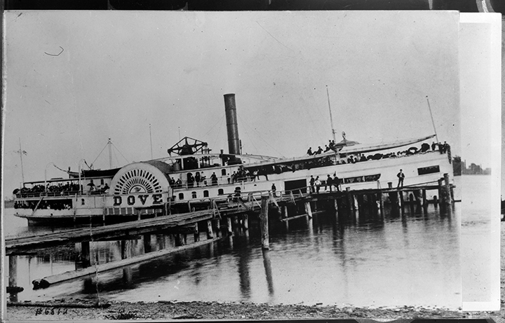 MS0091-03-01-18-018
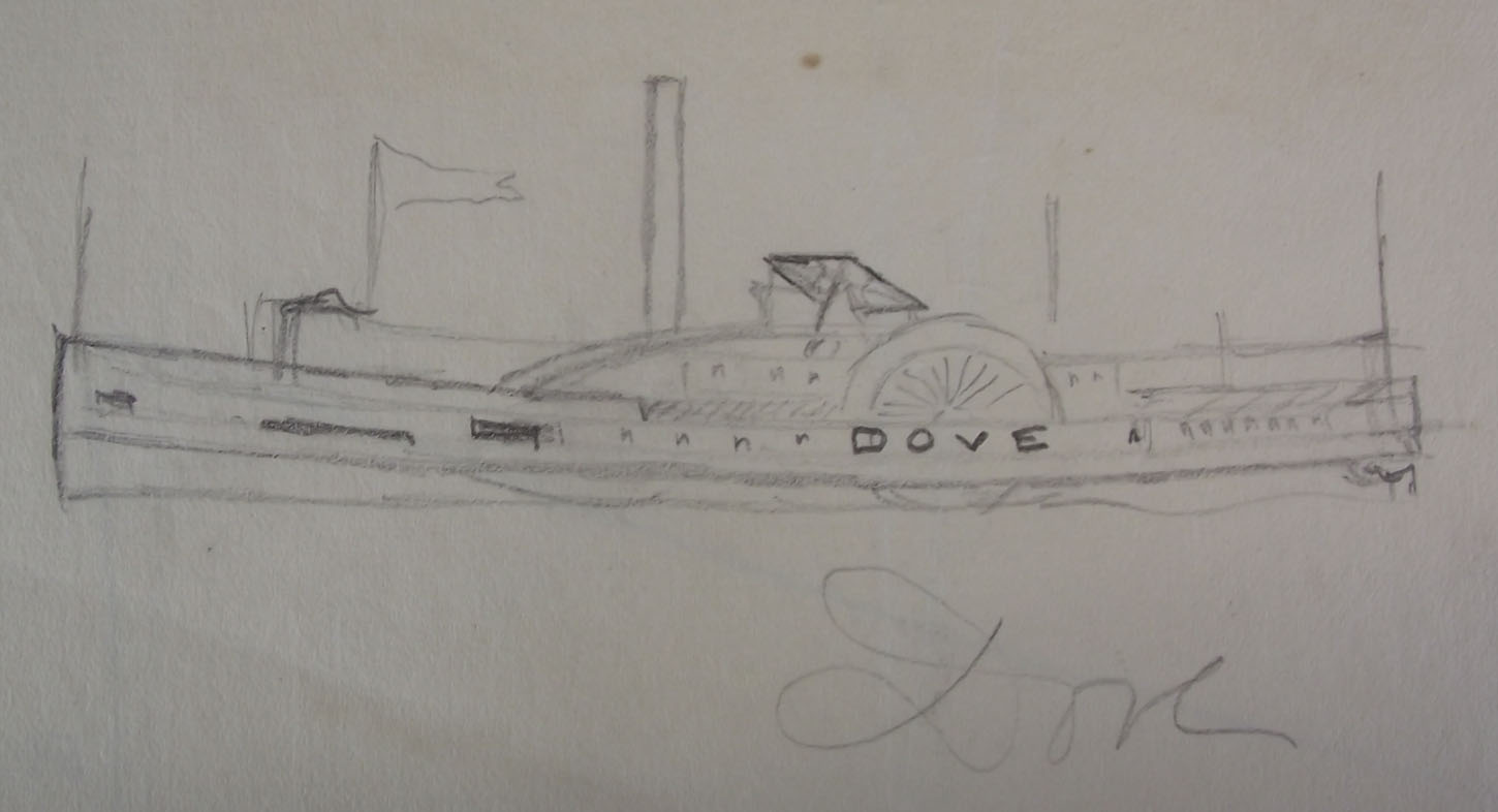 88-41-248
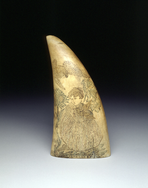 1935.0271.000001
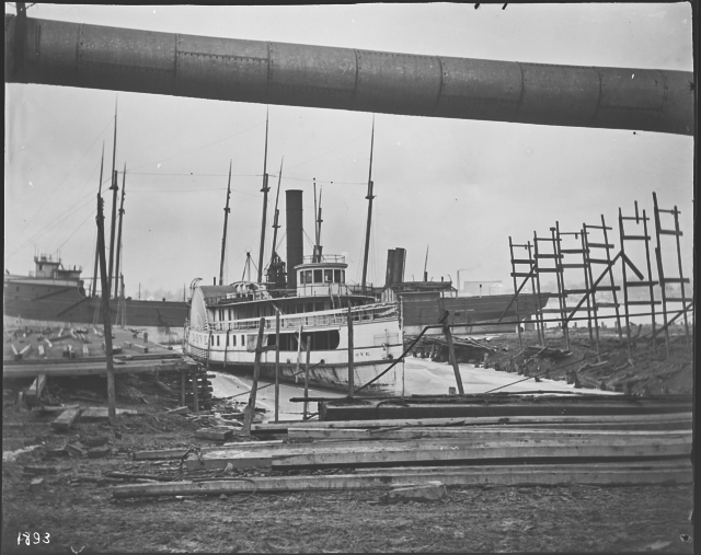 MS0094-1893 Dove
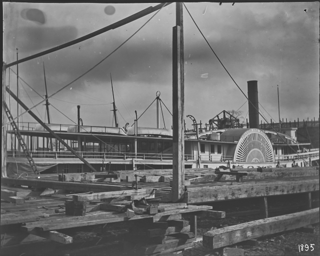 MS0094-1895 Dove
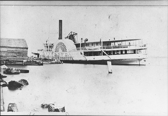 MS0091-03-02-0951
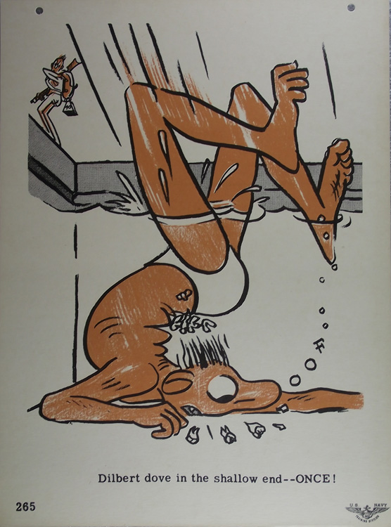 98-21-244
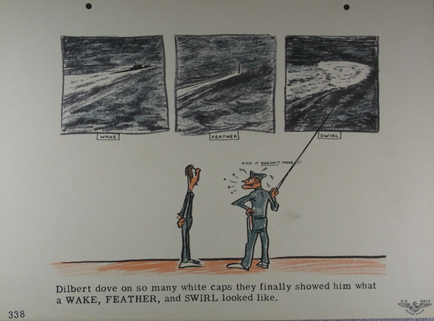 98-21-312
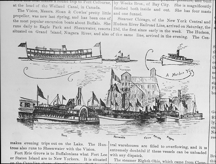 MS0091-03-01-07-120
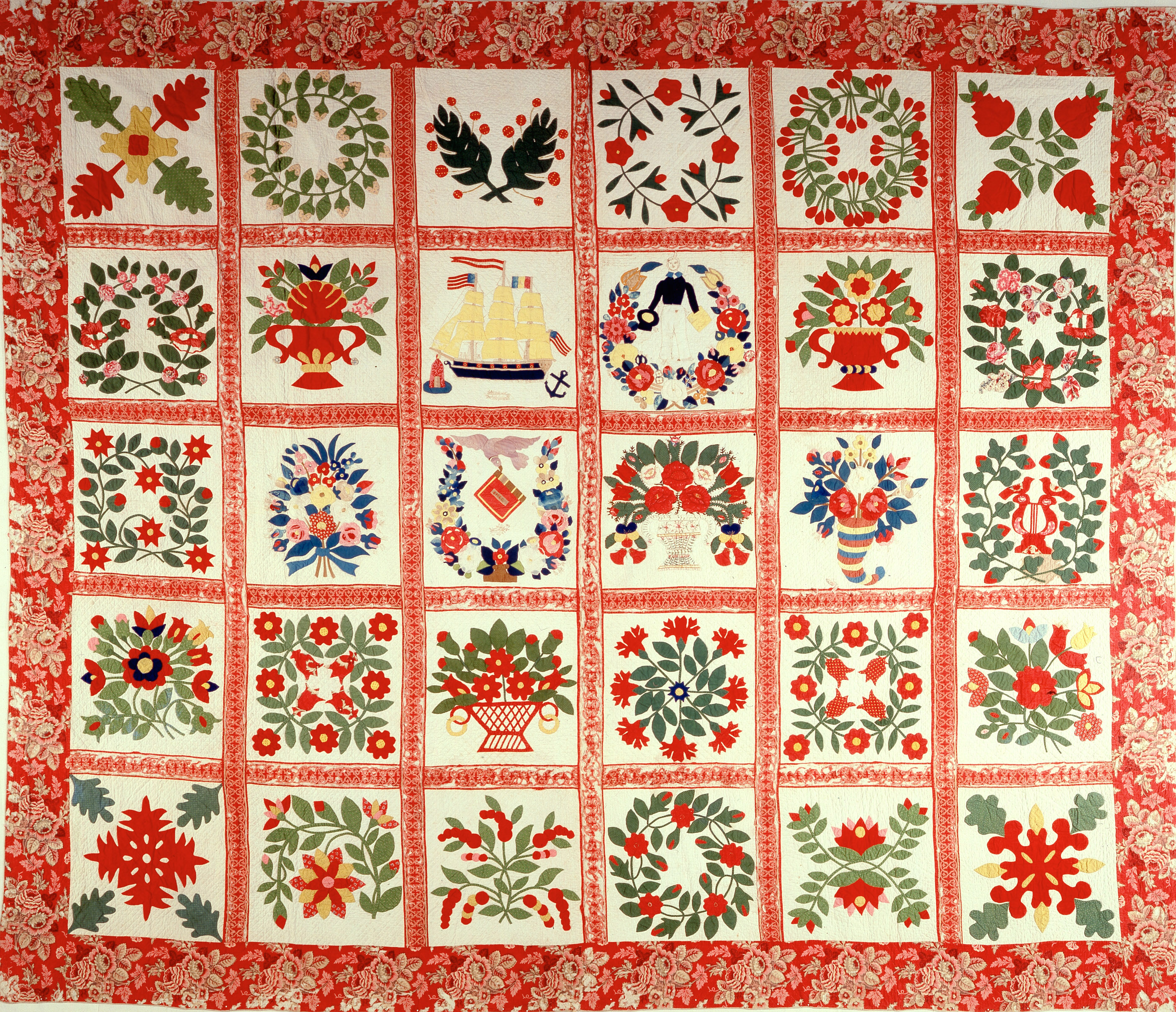 Full-size image
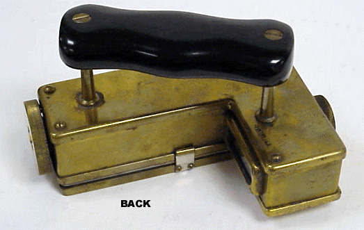 Full-size image
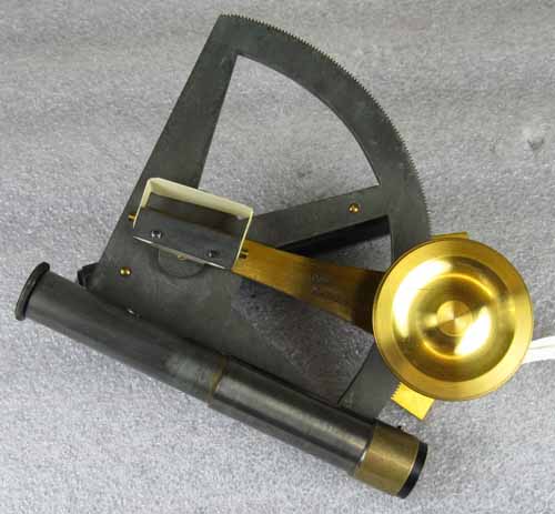 03-03-31a
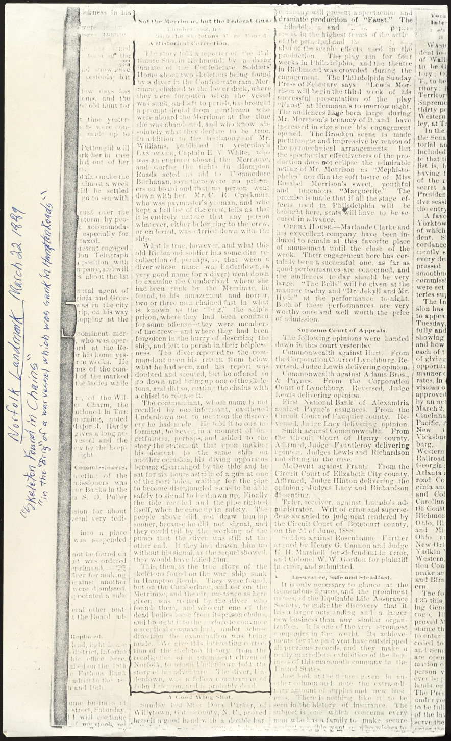 MS0164-001-07-008-17.09
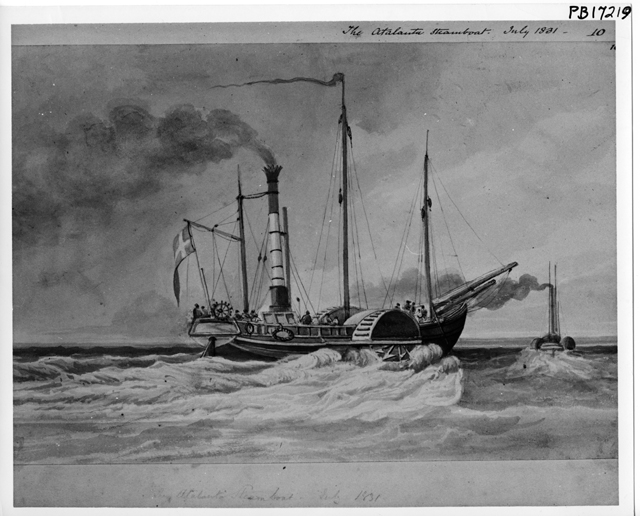 Full-size image
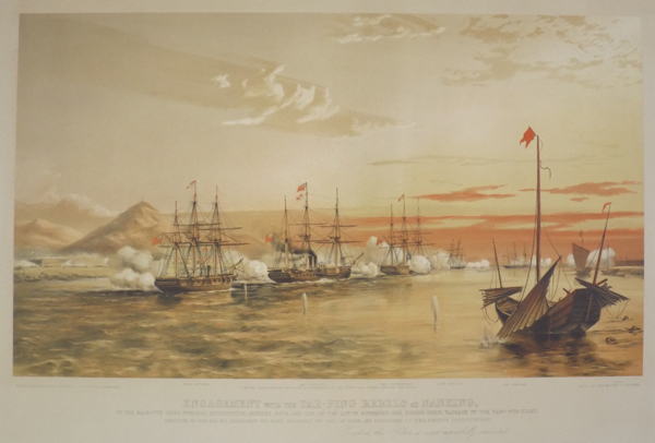 lp4624
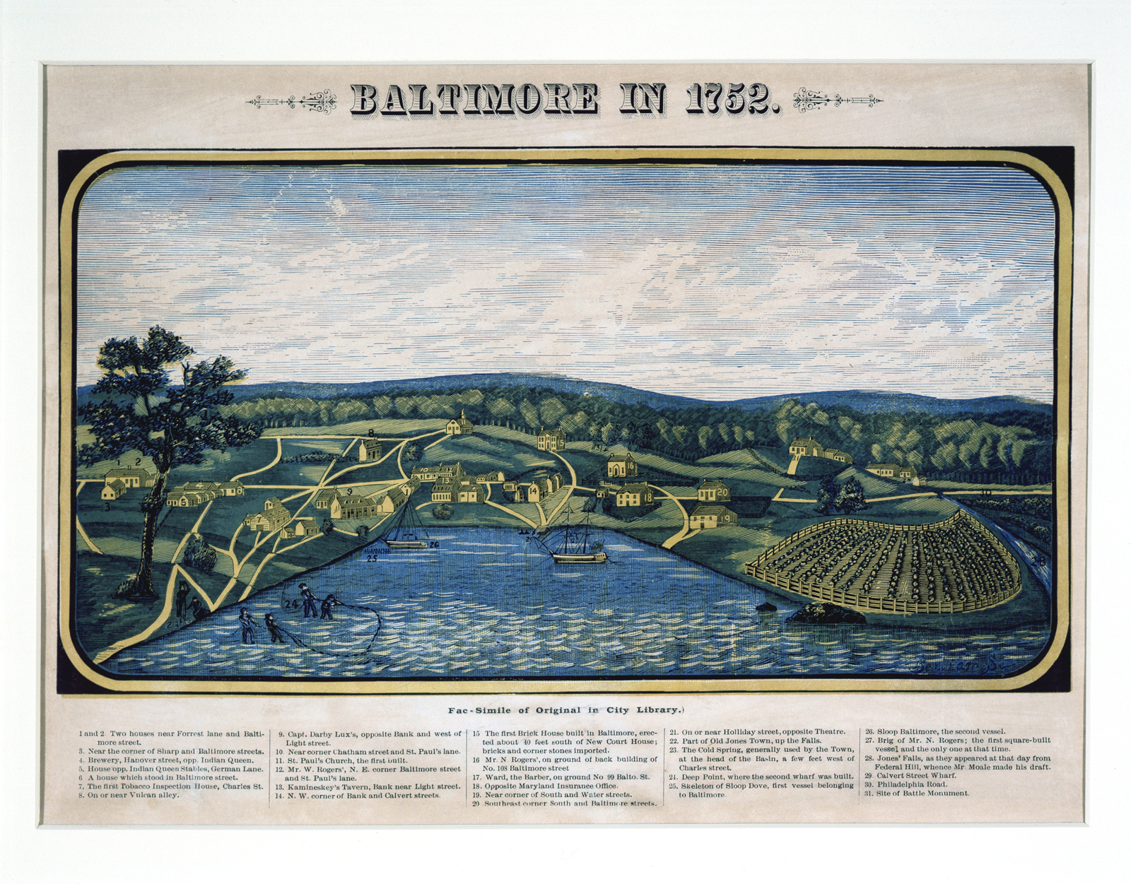 1934.1139.000001
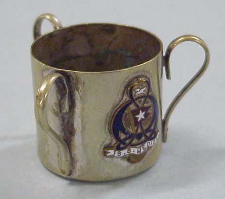 Full-size image
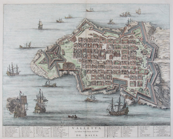 le499
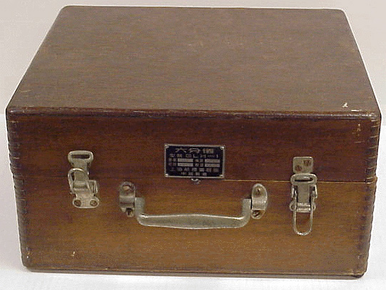 Full-size image
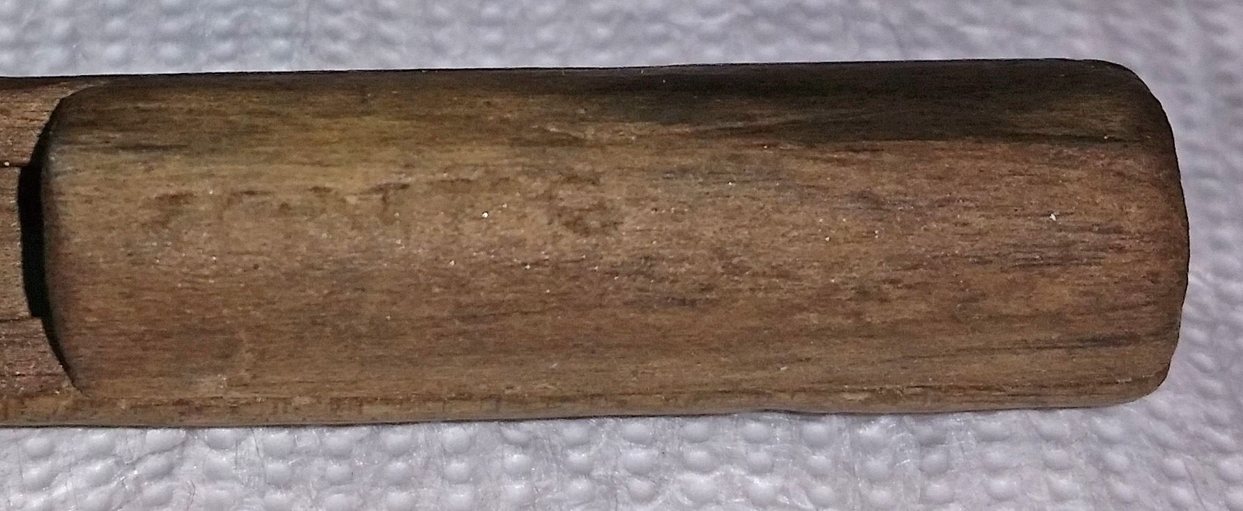 Maker's mark
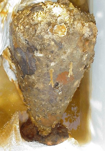 F01 BT1
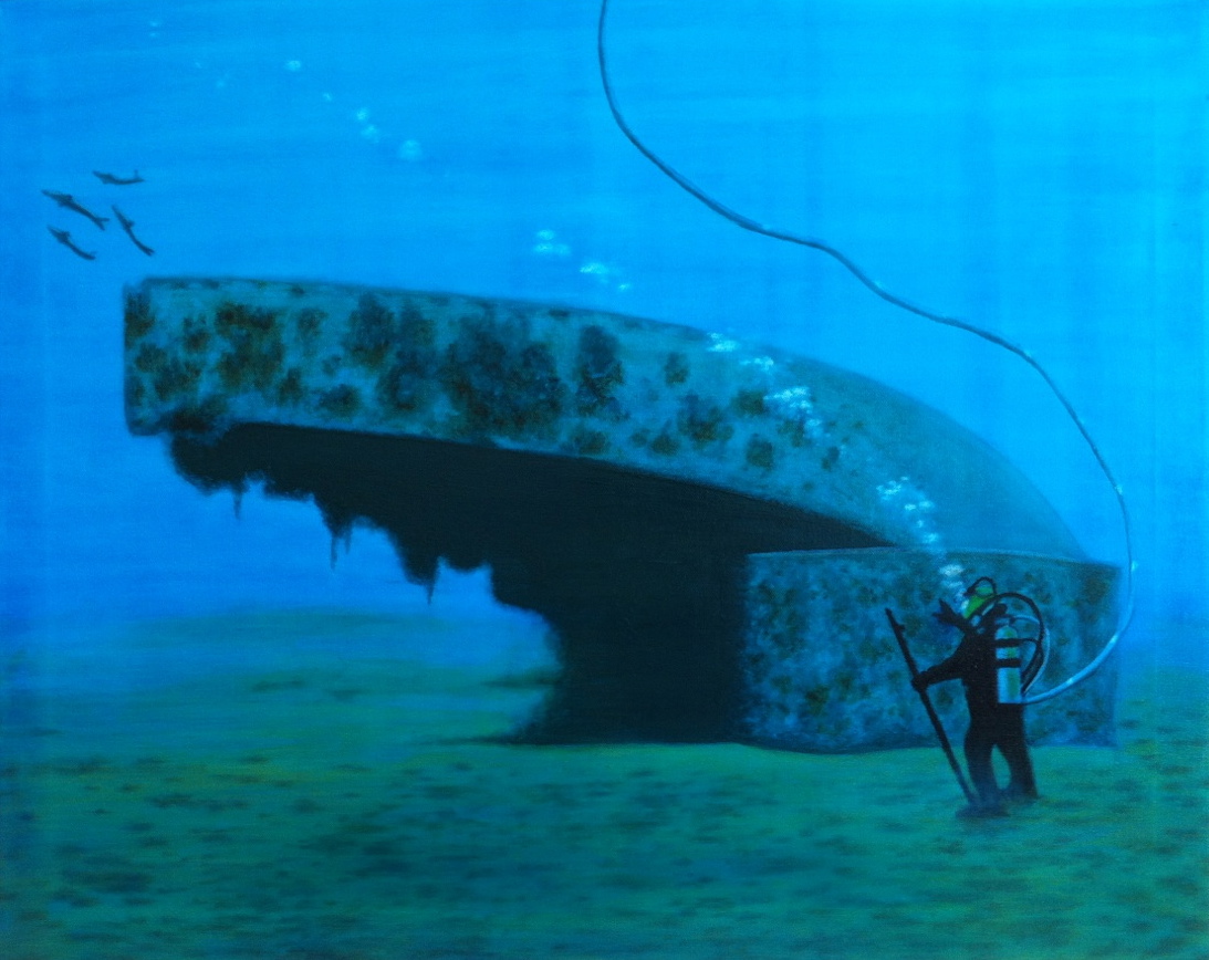 13-03-01
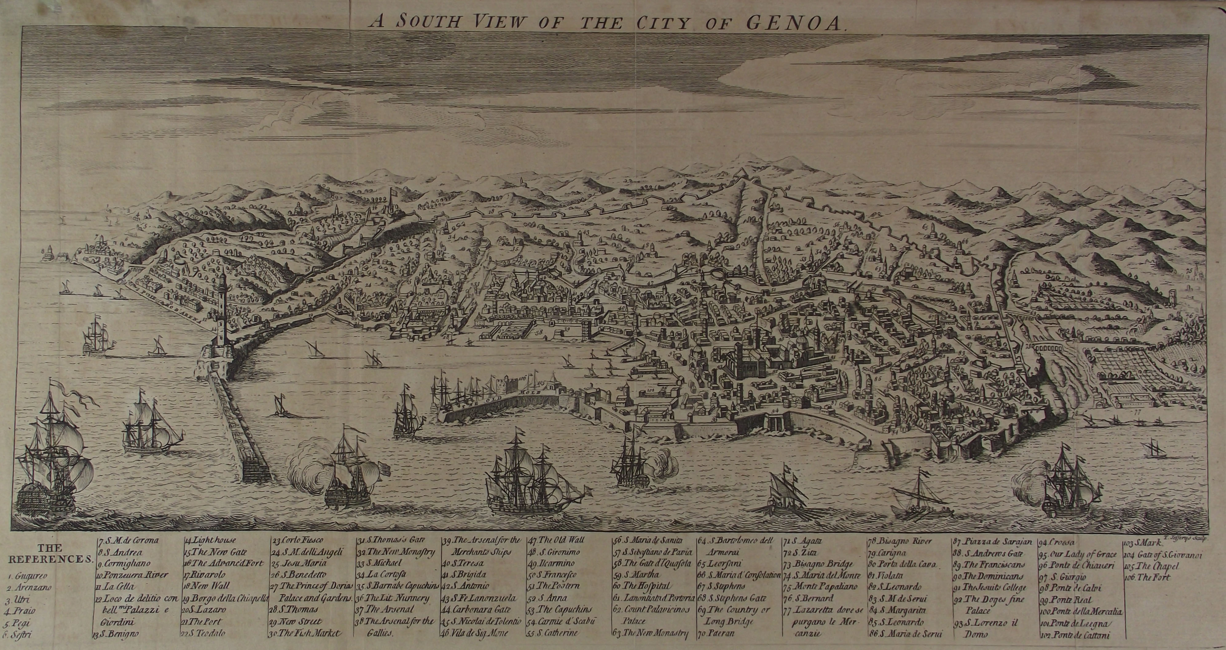 Full-size image
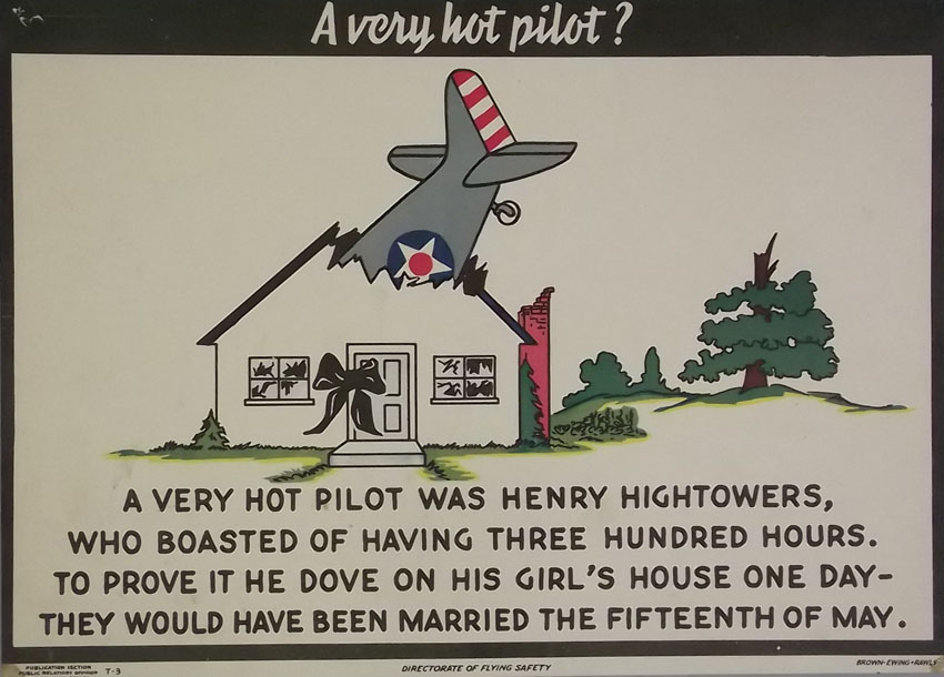 ln264
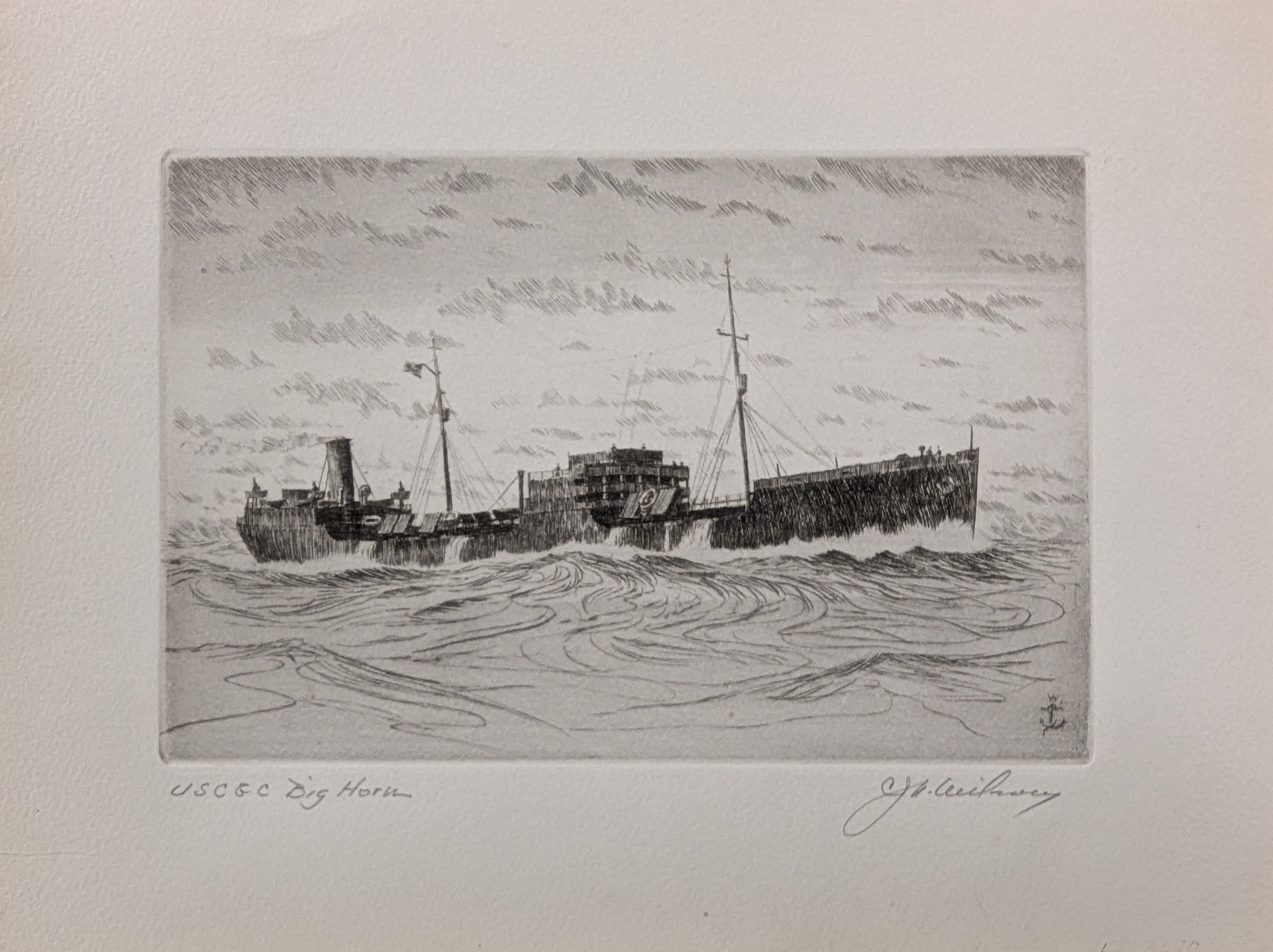 LE3370_1
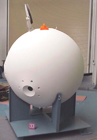 Full-size image
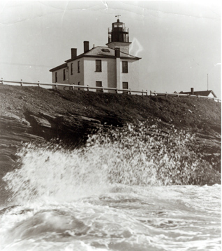 Full-size image
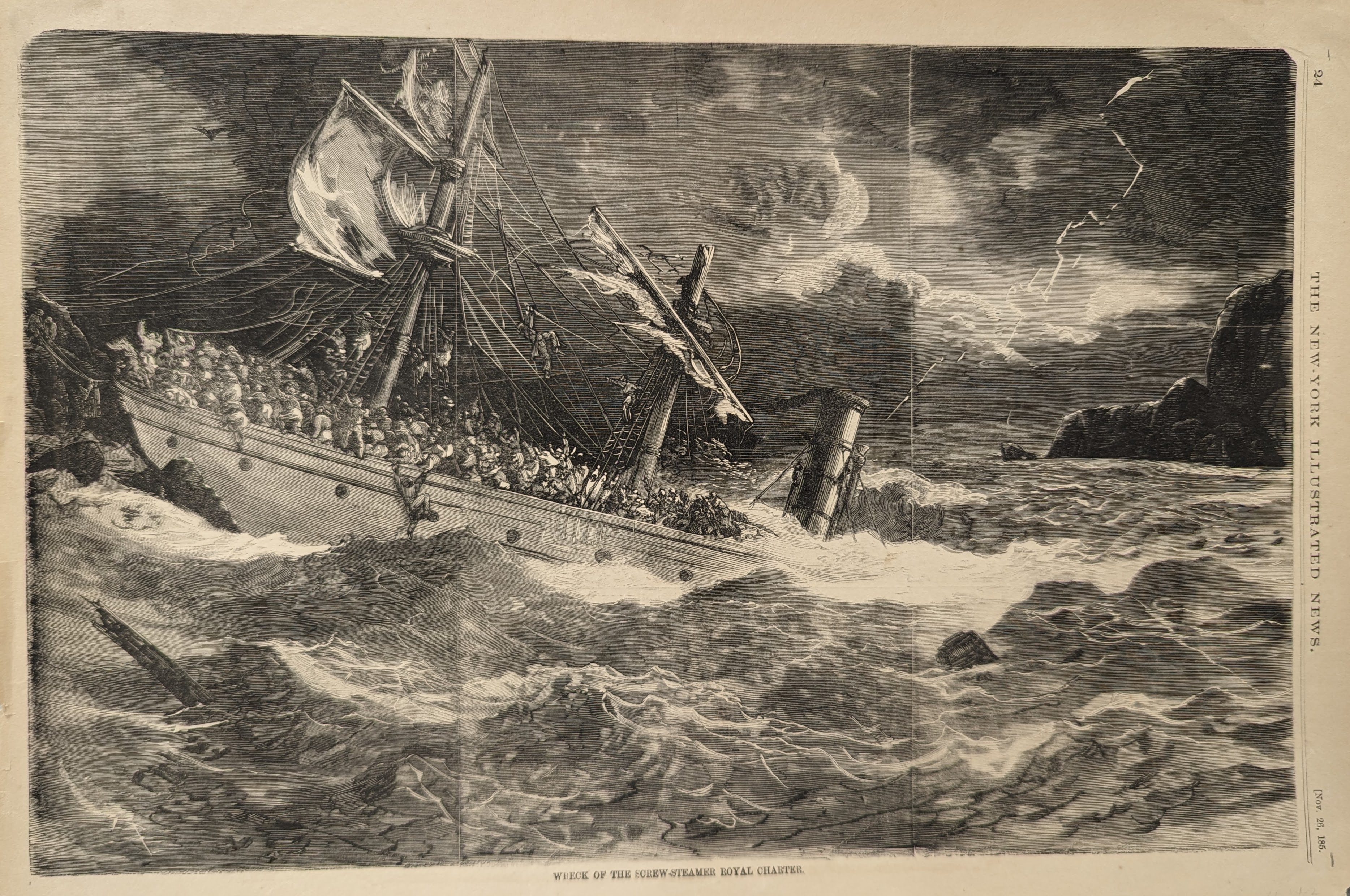 LP3432
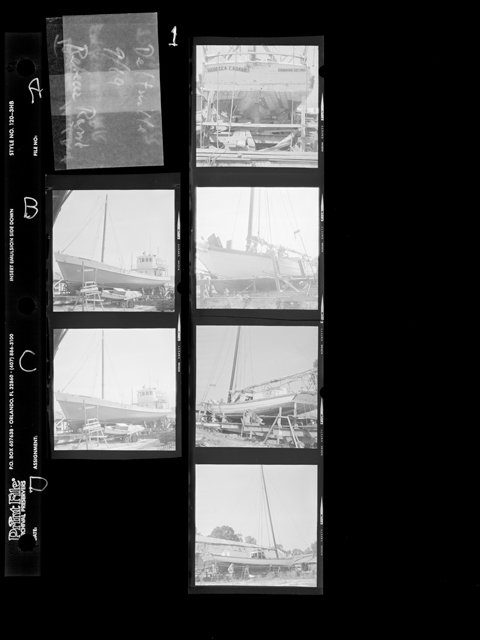 SAT-MS0199-0227
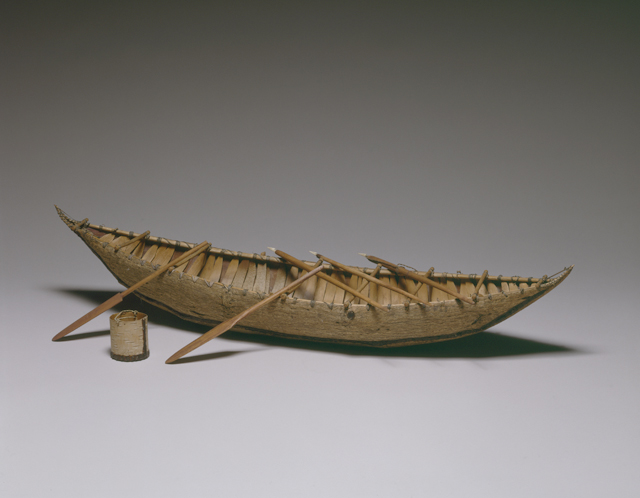 MP151
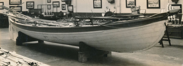 bu2b
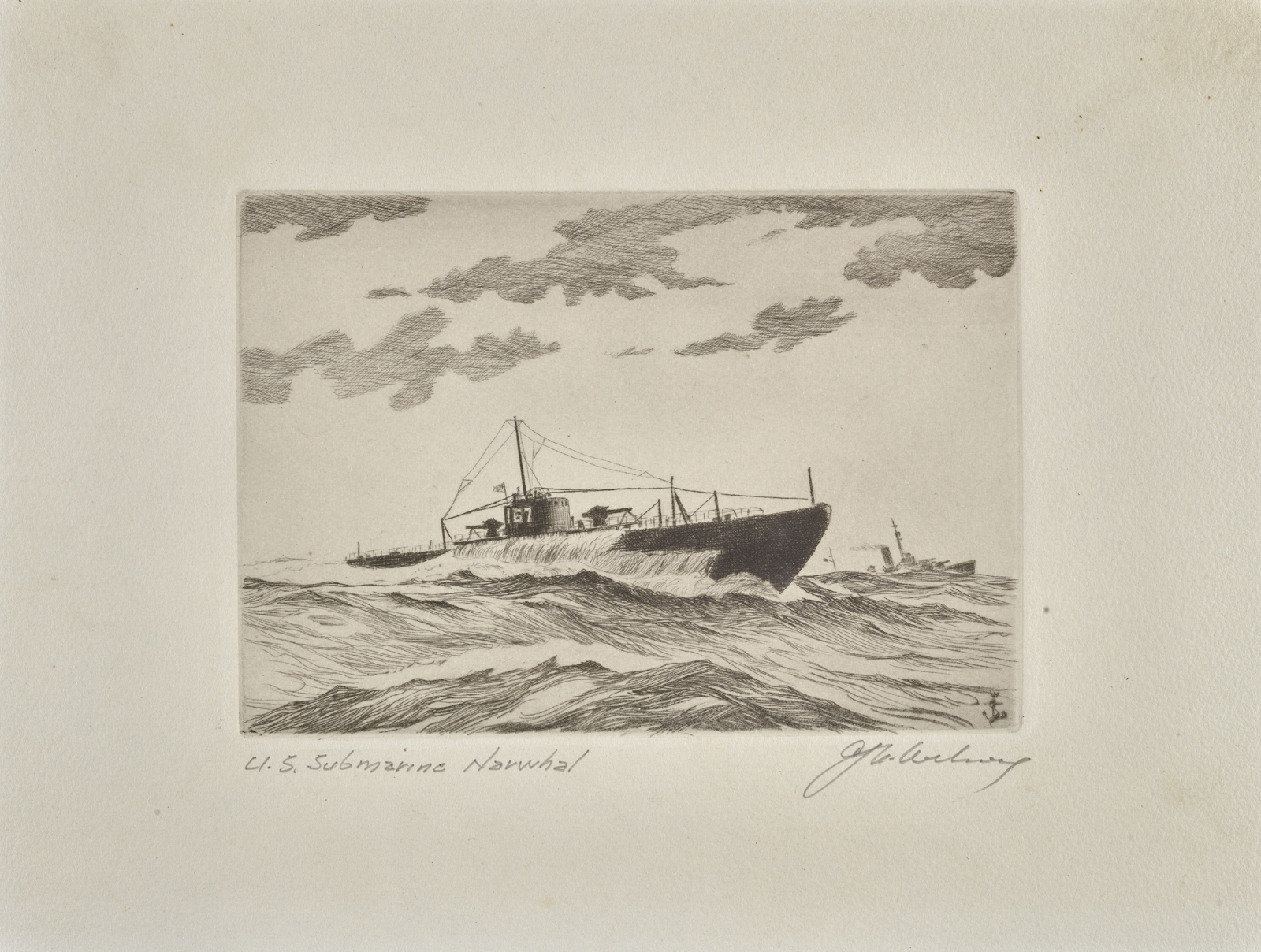 1941.0370.000001
 Central join explained